The Cevennes
Geographic location
The Cevennes are a mountainous region forming part of the Massif Central, and extending mainly over the departments of Lozere, Gard and Herault. The southern part has a Mediterranean climate, while the region of Mont Lozere and Mont Aigoual has a more mountainous climate, given the altitude of these two massifs.
Town of Ales, which is considered the capital of the Cevennes, as well as the town of Grand’Combe were an important mining center. Today only a few steel towers from old mine shafts bear witness to this bygone past.
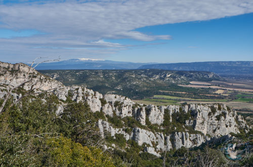
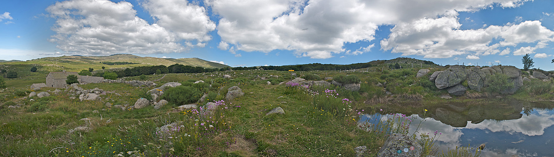
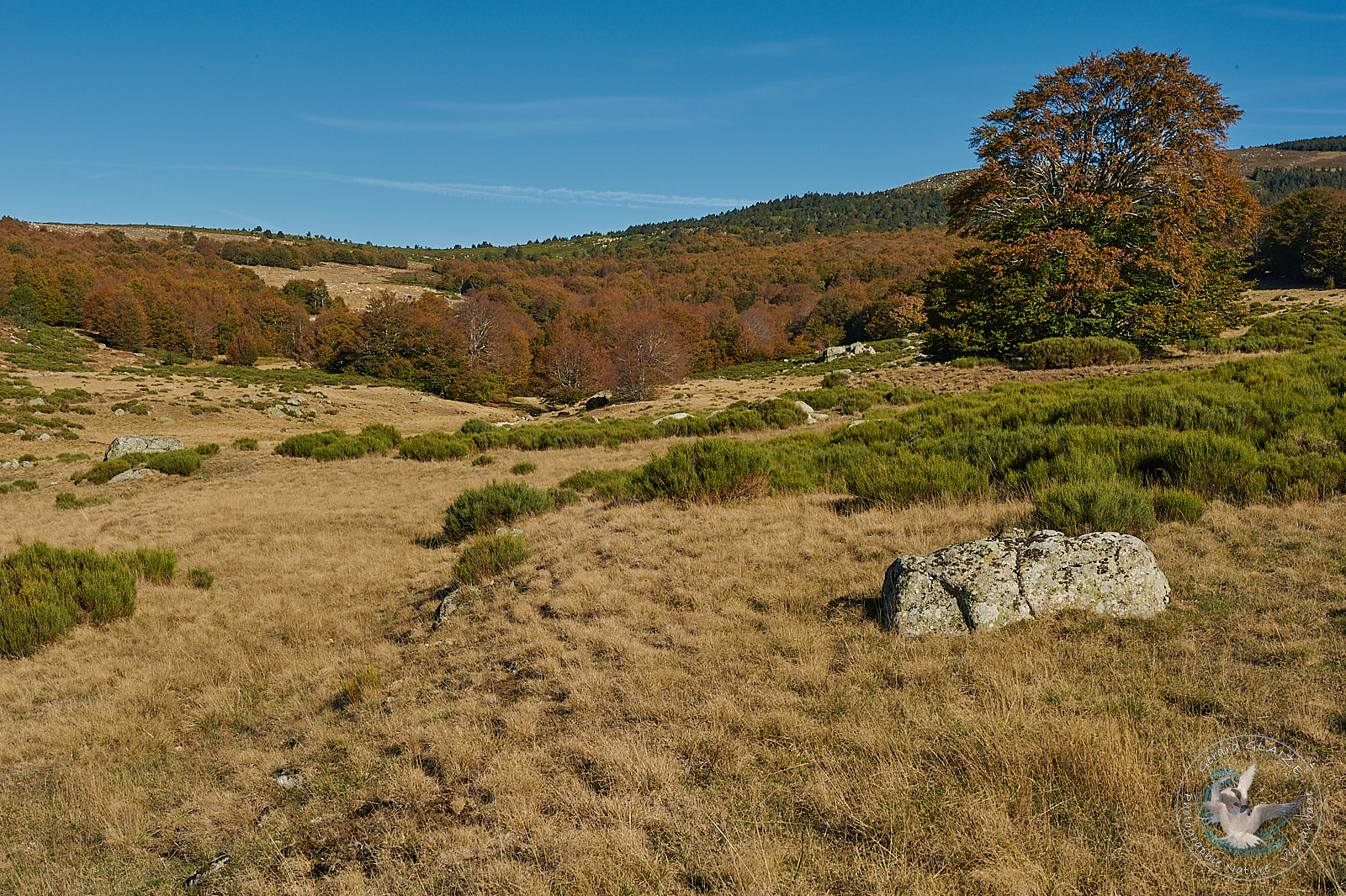
Cevennes National Park is located almost entirely in the Lozere department. This was created in 1970. Its creation had a long history since the idea dates back to 1914. This park has a unique feature among national parks, that of sheltering in particular a large permanent population. They are mostly farmers.
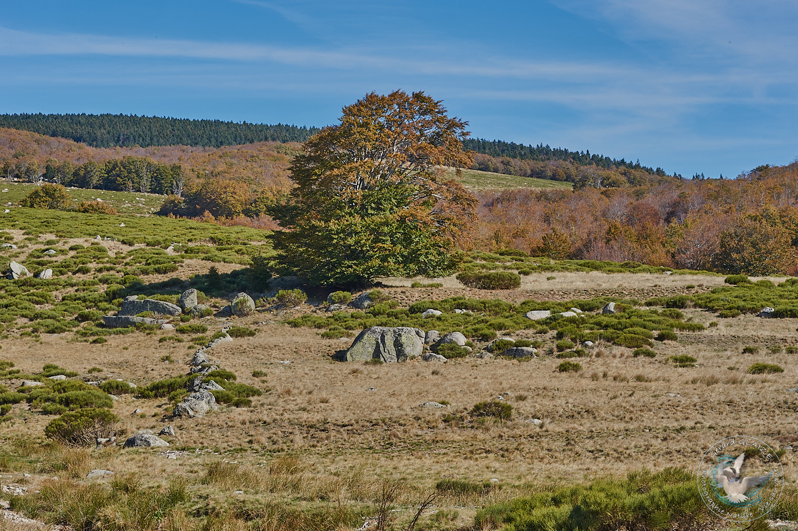
One of the particularities of the Cevennes National Park is its great diversity of landscapes:
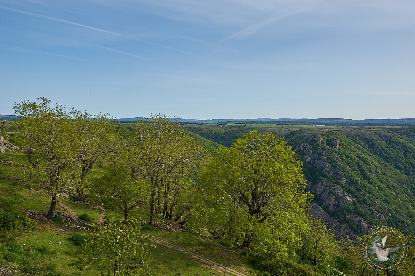
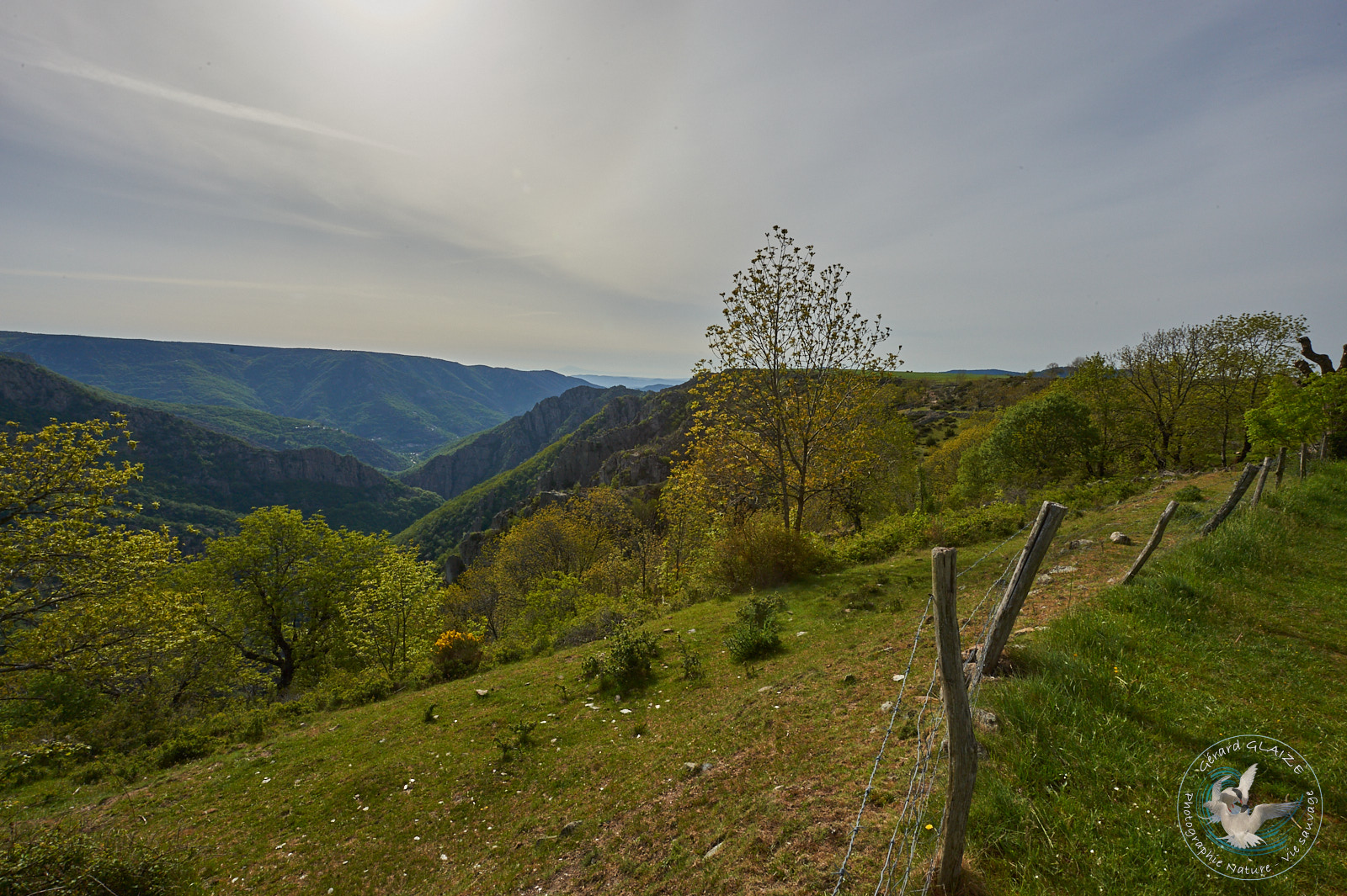
- the Causses and the Tarn gorges in particular,
- its geological complexity: limestone alternates with shale and granite, these geological differences are therefore found in the vegetation.
- wooded areas also cover almost two thirds of the park (it is the only national forest park in mainland France) and there is a wide variety of species: holm oak, maritime pine, beech, fir and of course chestnut, l Cévennes breadfruit tree.
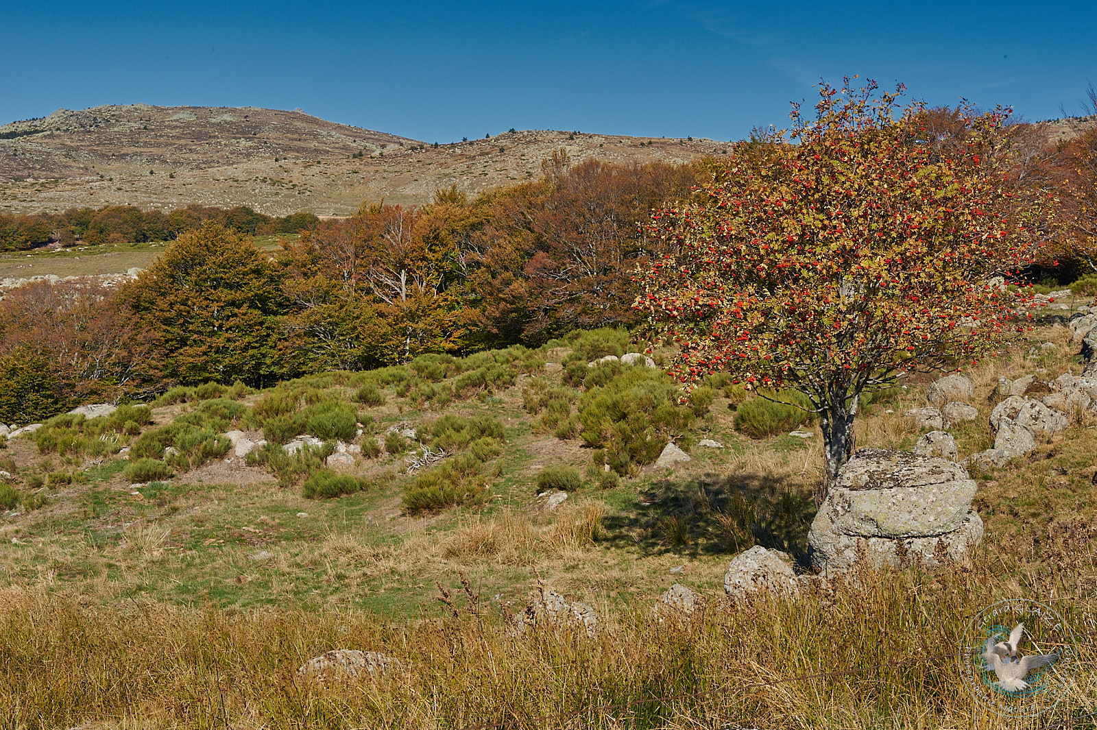
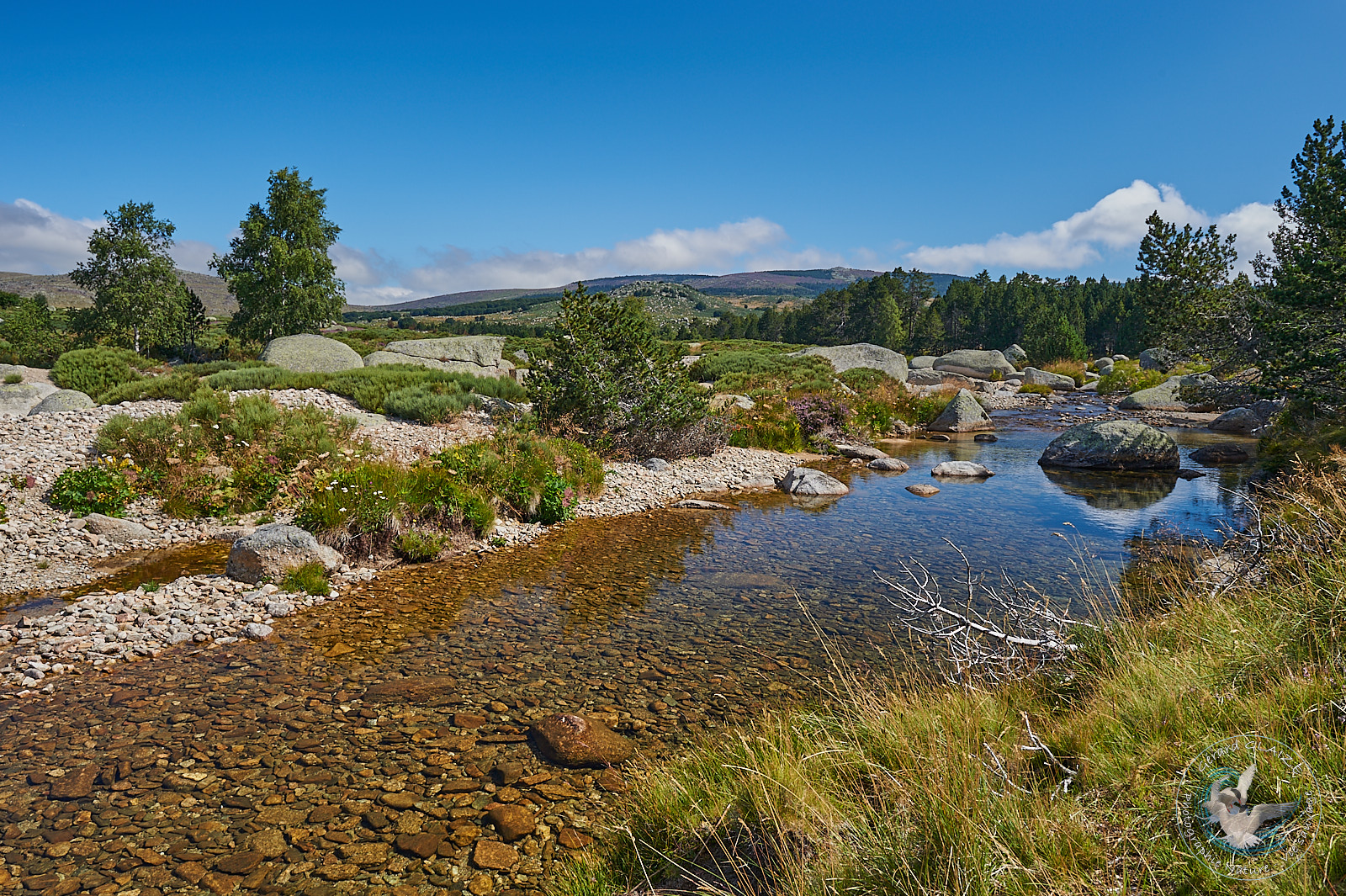
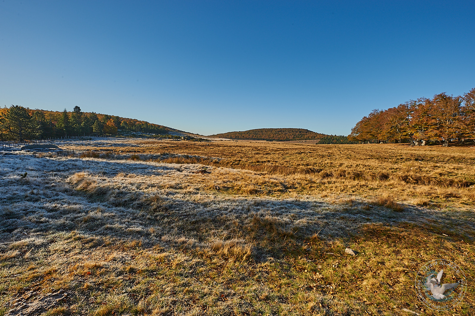
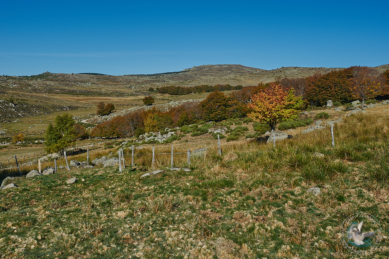
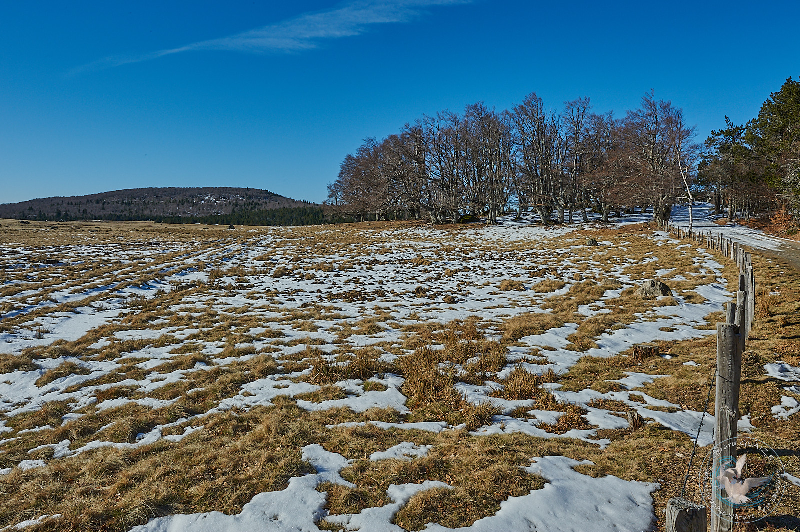
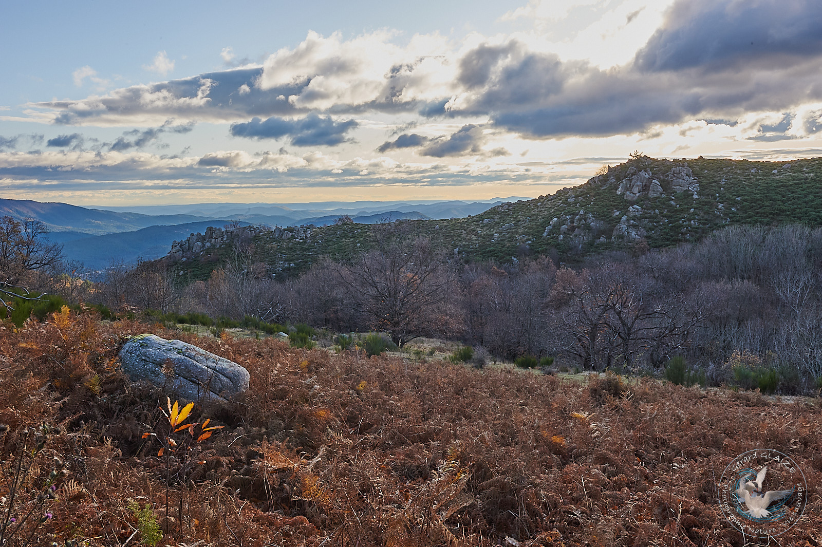
Mont Lozere
Mont Lozère forms a heavy granite relief, which also contrasts with the acute shapes of the schistose Cévennes, and the limestone of the Grand Causses. This diversity of rock has marked the architecture of each of the Cévennes regions. Mont Lozère is the highest granite peak in the Massif Central with 1,699 meters of altitude at Pic de Finiels.
Pic Cassini, with its 1,680 meters of altitude, is the second summit of Mont Lozère. This summit was named in homage to the French geographer Jacques Dominique Cassini, who established the first geographical maps of our country. From this summit the view takes in a magnificent landscape, ranging from the Alps to the highest peaks of the Massif Central.
Of all the Cévennes, however, Mont Lozère is my favorite region. Here the Tarn is born which plunges into the small village of Pont de Montvert, and which goes towards the Atlantic, and many other small trout rivers, such as the Hommol and the Gourdouse.
You can tour Mont Lozère by bike if you are an experienced cycle tourist. Departure from the small village of Vialas, dominated by the rock of Trenze, direction Saint Maurice de Ventalon, then ascent of the Col de la Croix de Bertel (1,088 meters), then descent to the village of Pont de Montvert (and its 16th century bridge). ), climb towards Bleymard via the Col de Finiels (1,541 meters), direction Cubières, Altier and its Château du Champ, Villefort on the Regordane route, and return towards Génolhac and Vialas.
Mont Aigoual
Mont Aigoual culminating at 1,567 meters above sea level is the second peak of the Cévennes. It offers a panorama in good weather from the Alps to the Pyrenees and the Mediterranean. Its summit houses a meteorological observatory, built at the end of the 19th century.
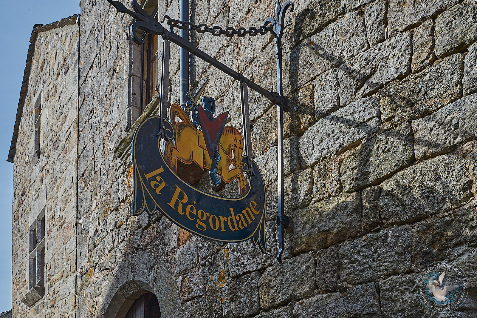
Regordane way
The Regordane way, a communication way from the 11th and 12th century between Nîmes and Puy en Velay, crosses this region. Its origin would even be much older and go back before Roman civilization. There are fortified points along the way: the Château de Portes (at the top of the pass of the same name), towards Alès. This medieval castle was built in the 11th century; while further north, after Villefort, is the medieval village (listed as a historic monument) of Garde Guérin, which dominates the Chassezac gorges. These gorges are wildly beautiful.
This way is one of the routes linking the ports of the Mediterranean, in particular that of Saint Gilles in the Gard, to the fairs of Champagne. The Regordane path turns out to be the easternmost path in the Kingdom of France. The port of St Gilles, whose Abbey houses the tomb of Saint Gilles, became a popular place for pilgrims, the Chemin de Regordane became widely known as the “chemin de Saint Gilles”. This route is one of the Way of Compostela. In the 13th century Aigues Mortes supplanted the silted port of St Gilles.
Knights of the Order of Malta
The paths and forests at the summit of Mont Lozere belonged until 1795 to the knights of the Order of St John of Jerusalem, who had established the commandery of the Hospitallers of Gap-Frances in the hamlet of l’Hôpital. Planted stones marked with the Maltese cross, emblem of the Order, bordered their property.
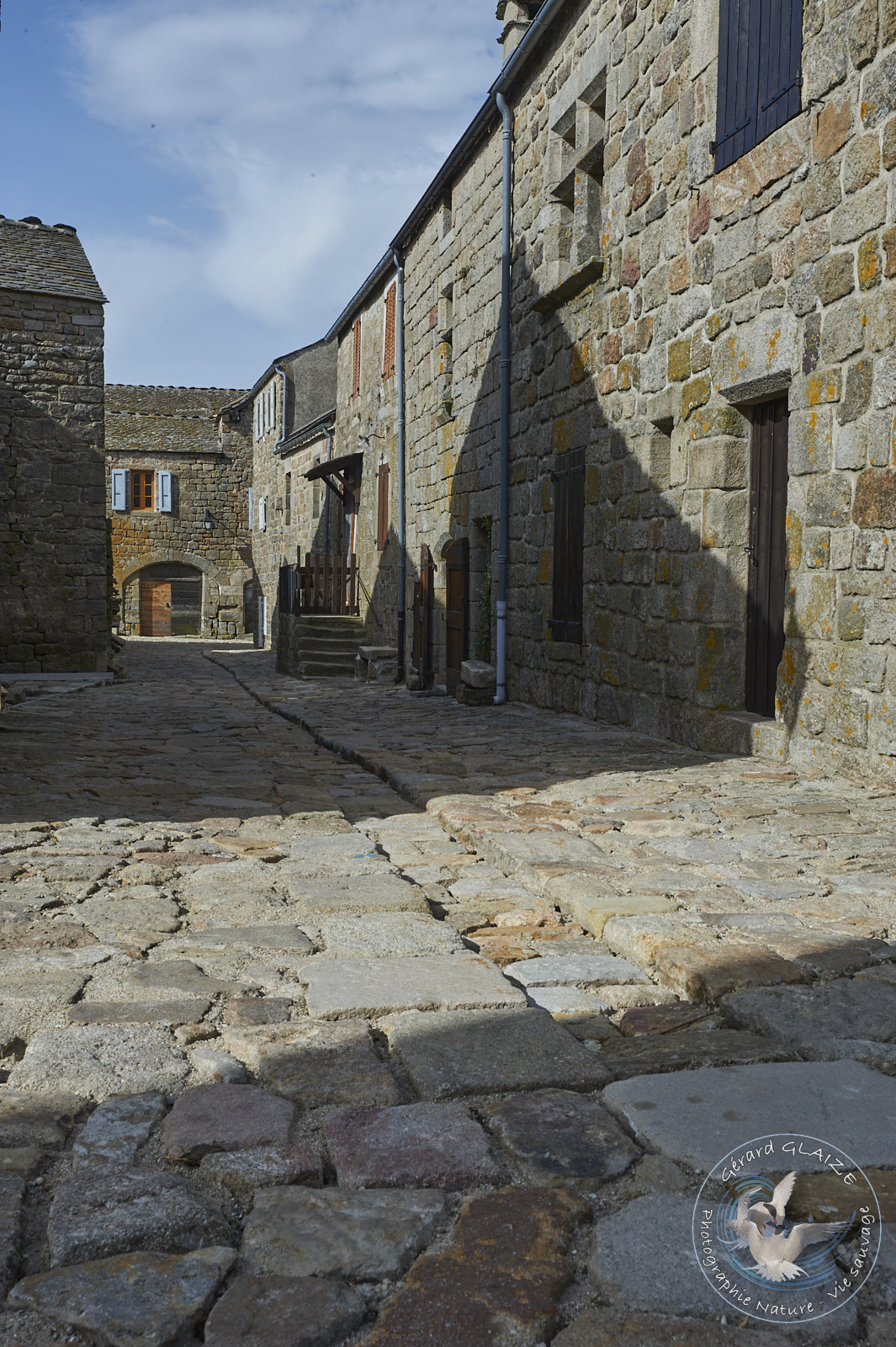
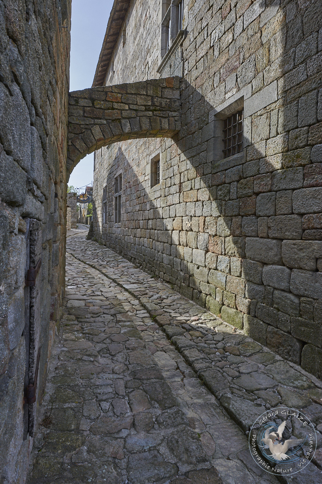
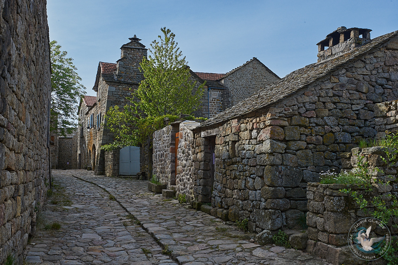
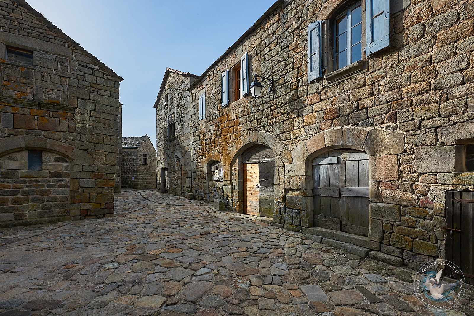
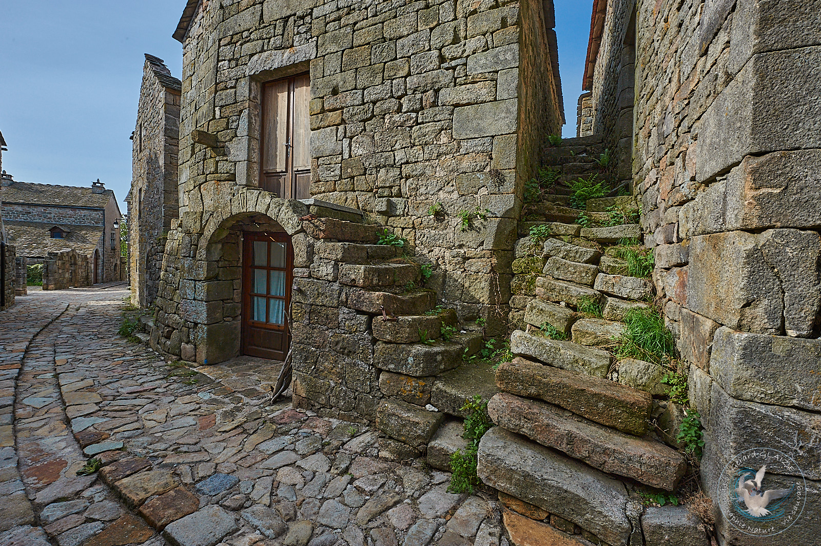
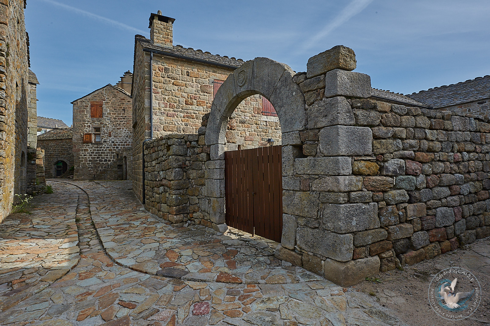
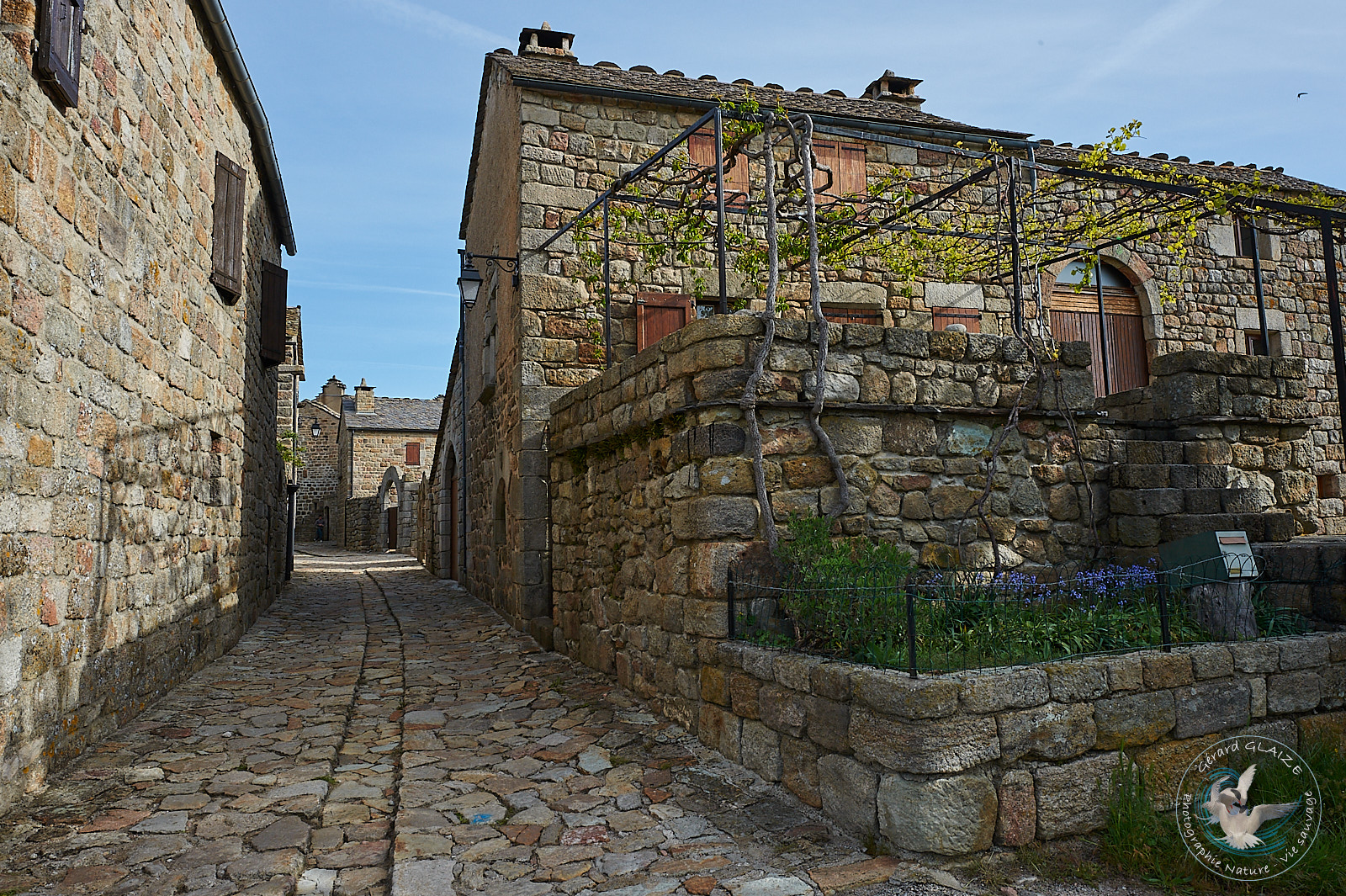
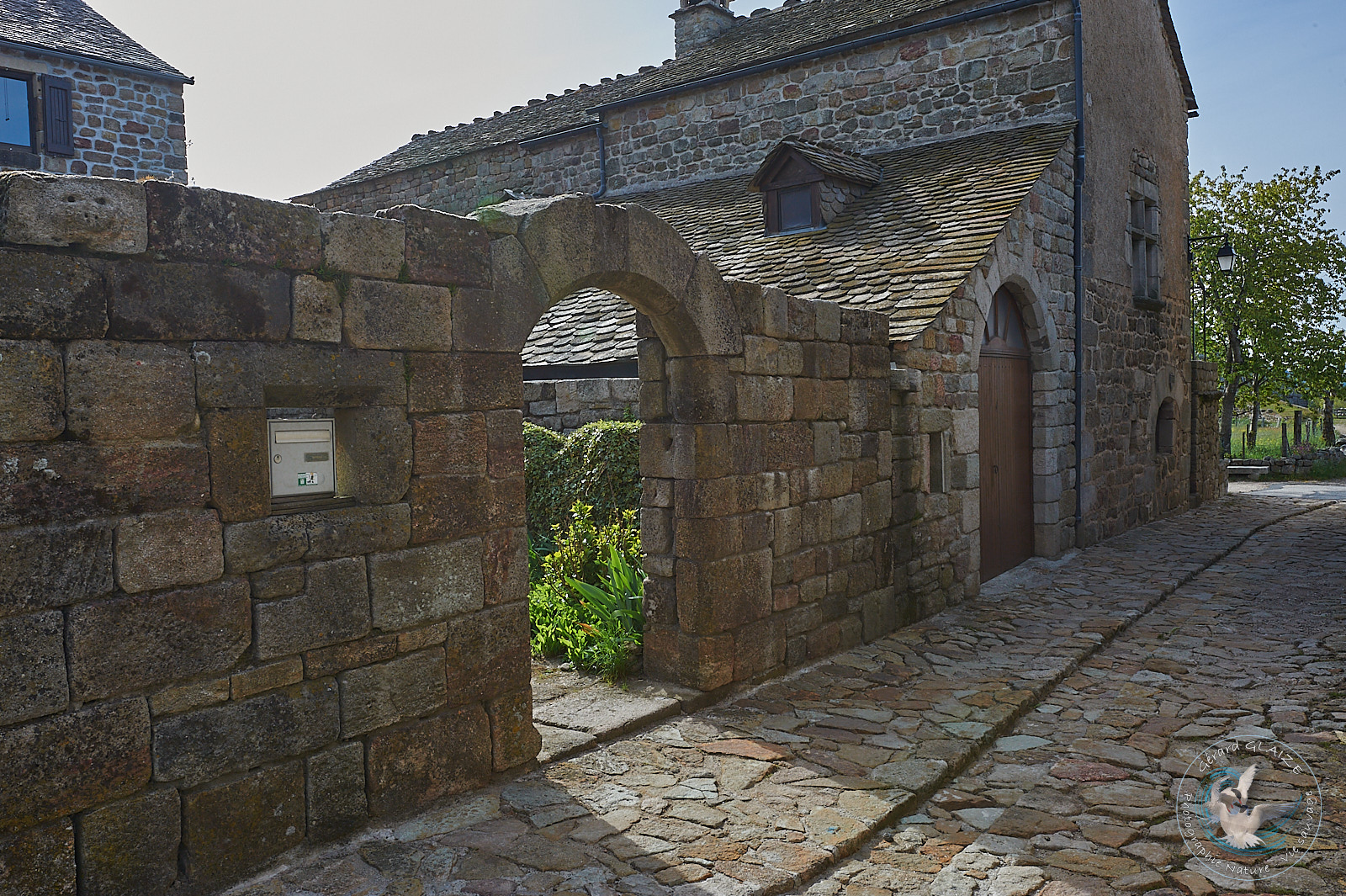
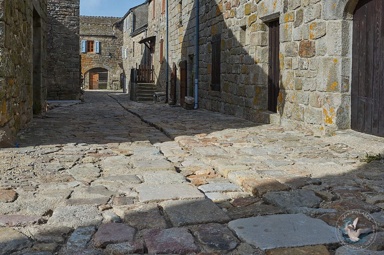
Architecture in the Cevennes
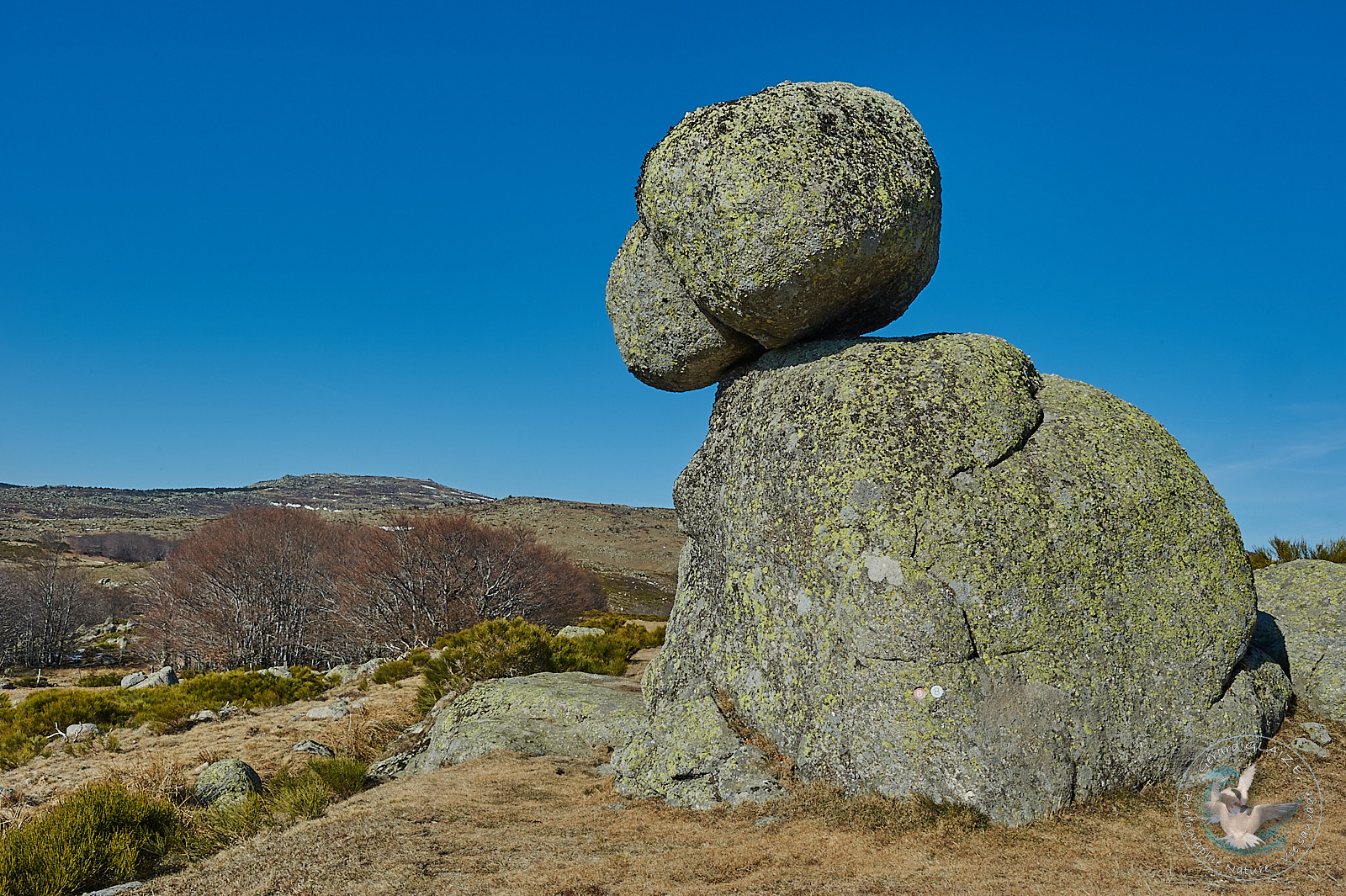
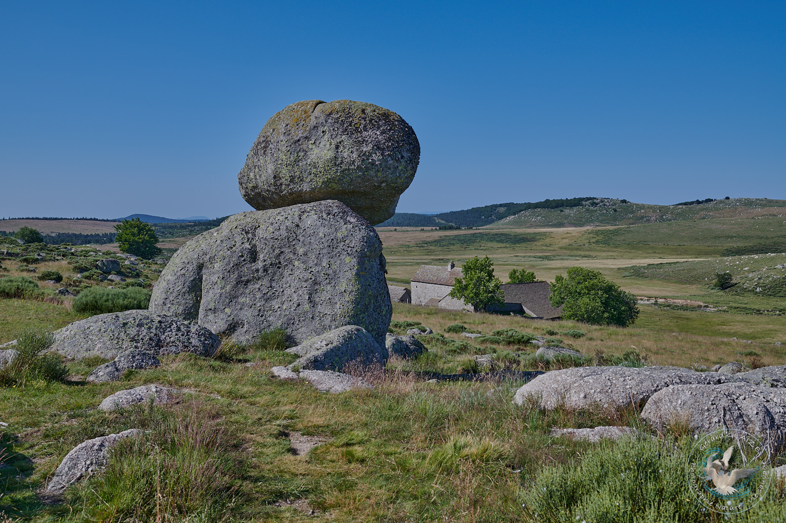
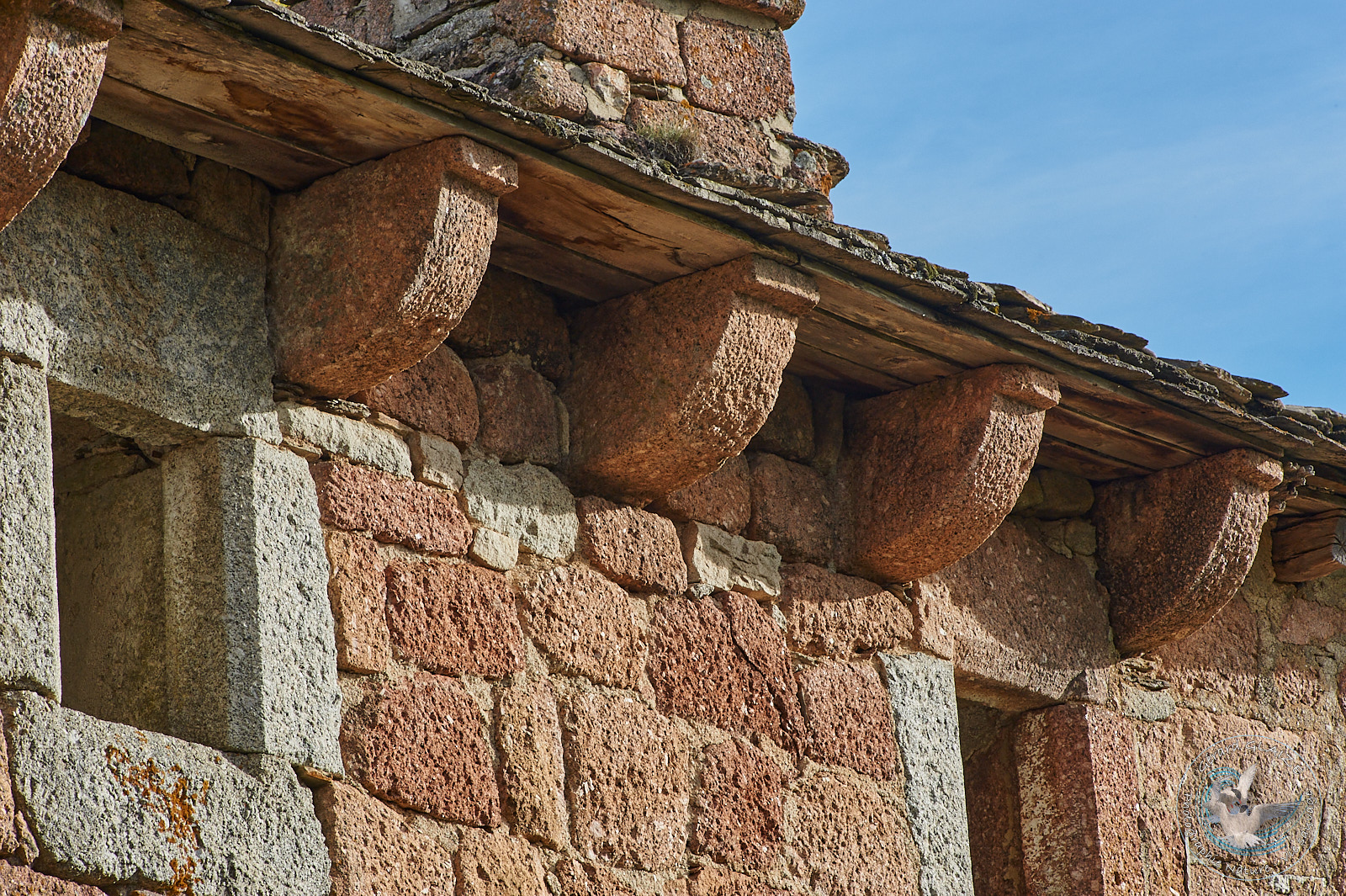
The preferred construction material in this region is undoubtedly granite. It is true that Mont Lozere constitutes a granite island in the middle of the ocean of limestone of the Causses, and the schist that is also found in the Cevennes.
Three types of rocks : granite, schist, and limestone were used in the construction of the habitat and shaped the landscape. The architecture is adapted to climatic conditions and to the needs linked to the rural lifestyle. Constructions are made to withstand time, in all weathers….
The Bell Towers of storm
On the northern flank of Mont Lozère, there are numerous hamlets located at a high altitude, and therefore exposed to harsher climatic conditions in winter, particularly exposed to snow storms in winter. The great danger for the inhabitants and travelers of the time was the snow storms. Snow swept by a violent wind soon made you lose your direction. Also the Lozerian mountain people had imagined and built “the bell towers of storm”. As soon as the storm became too violent, the bells began to ring day and night, allowing travelers, shepherds, mule drivers or lost villagers to find their way. The storm bell tower is to mountaineers what the lighthouse is to sailors.
Some of these bell towers of storm 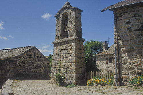 are visible at la Fage, at Serviès, at Sagnes, and at Oultet.
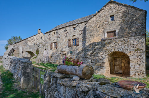
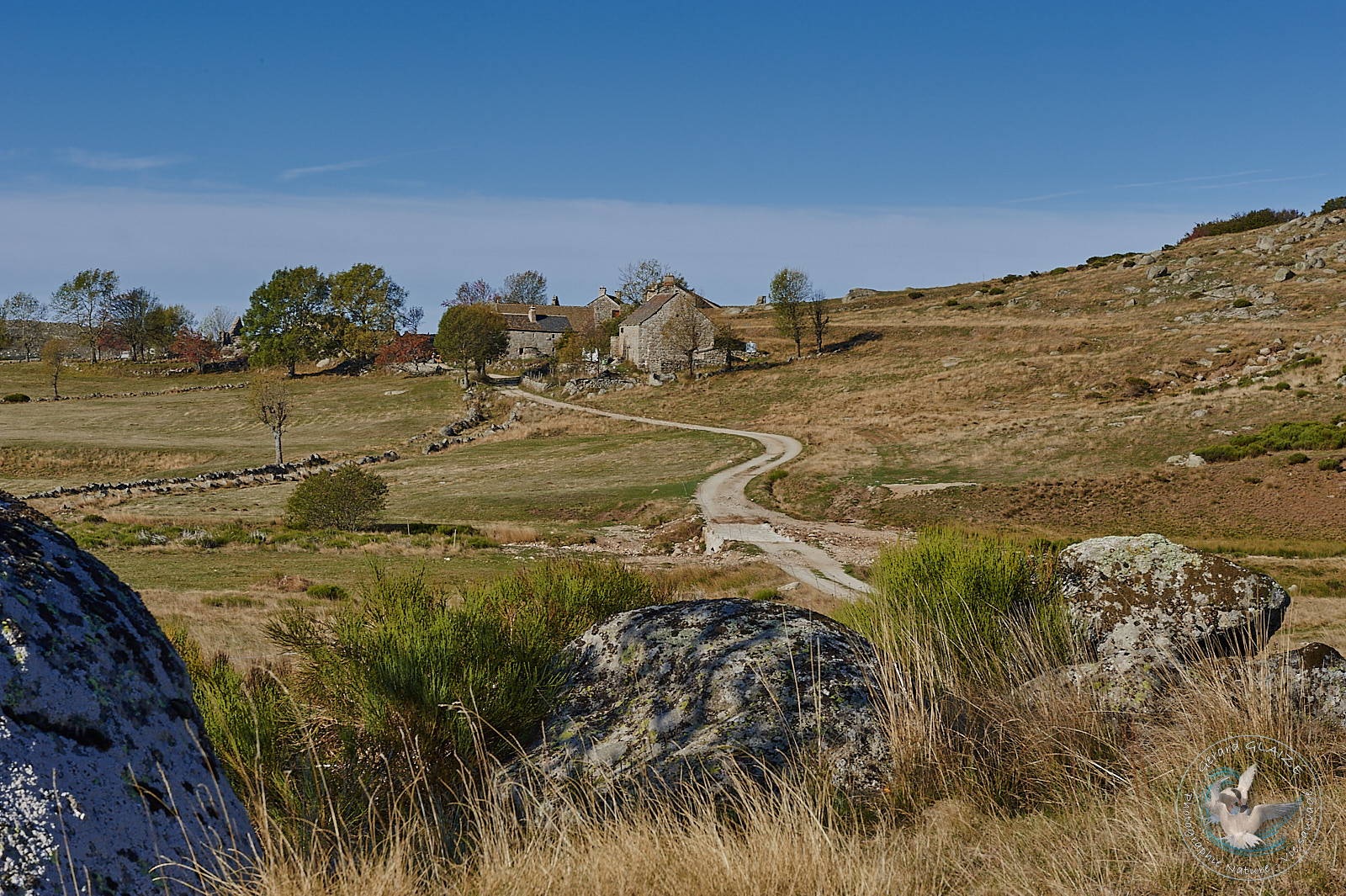
The Cevennes Farms
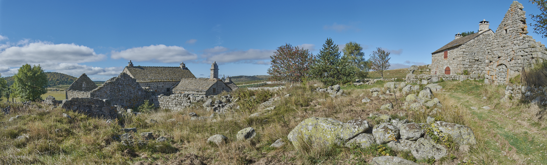
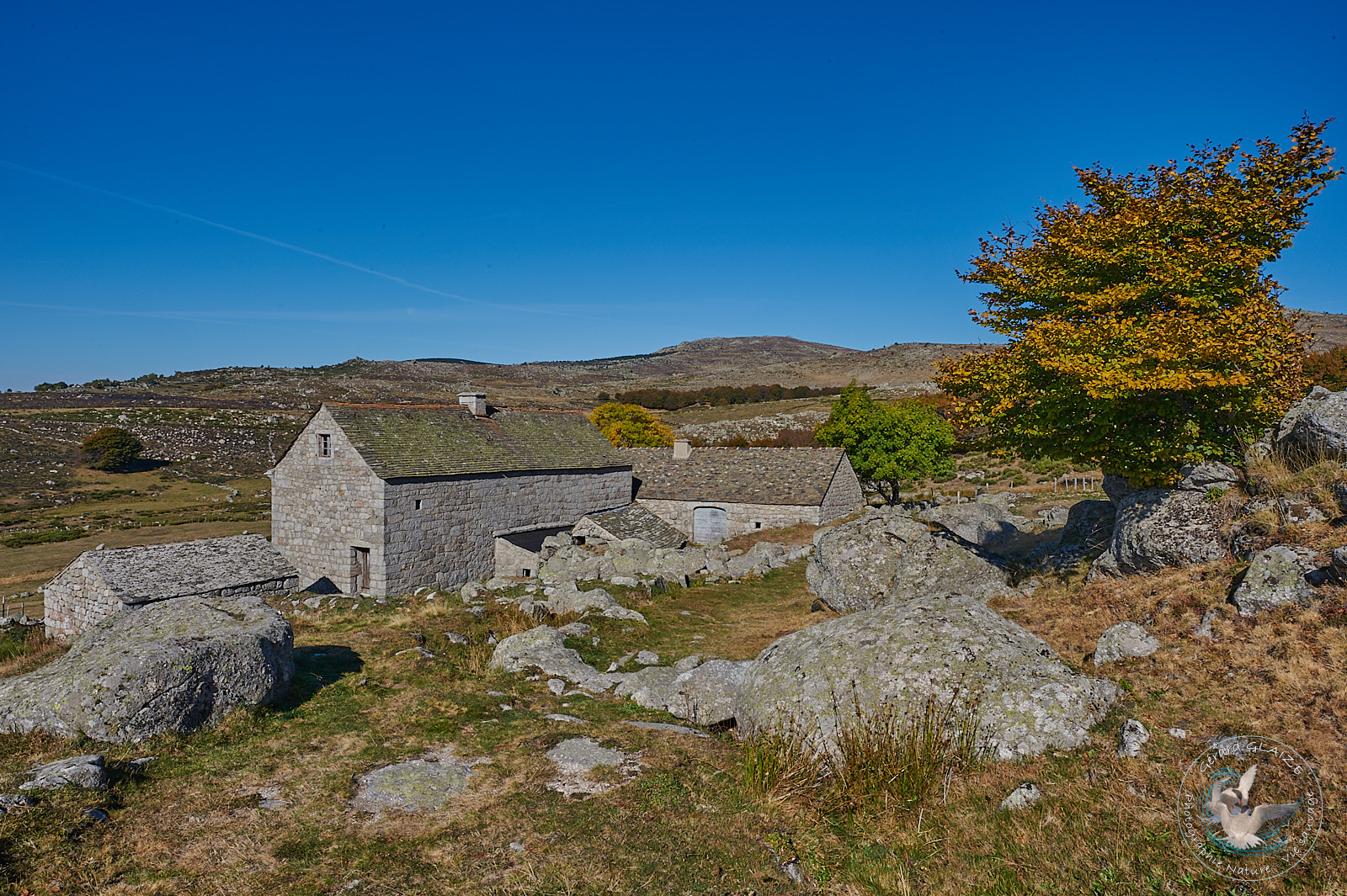
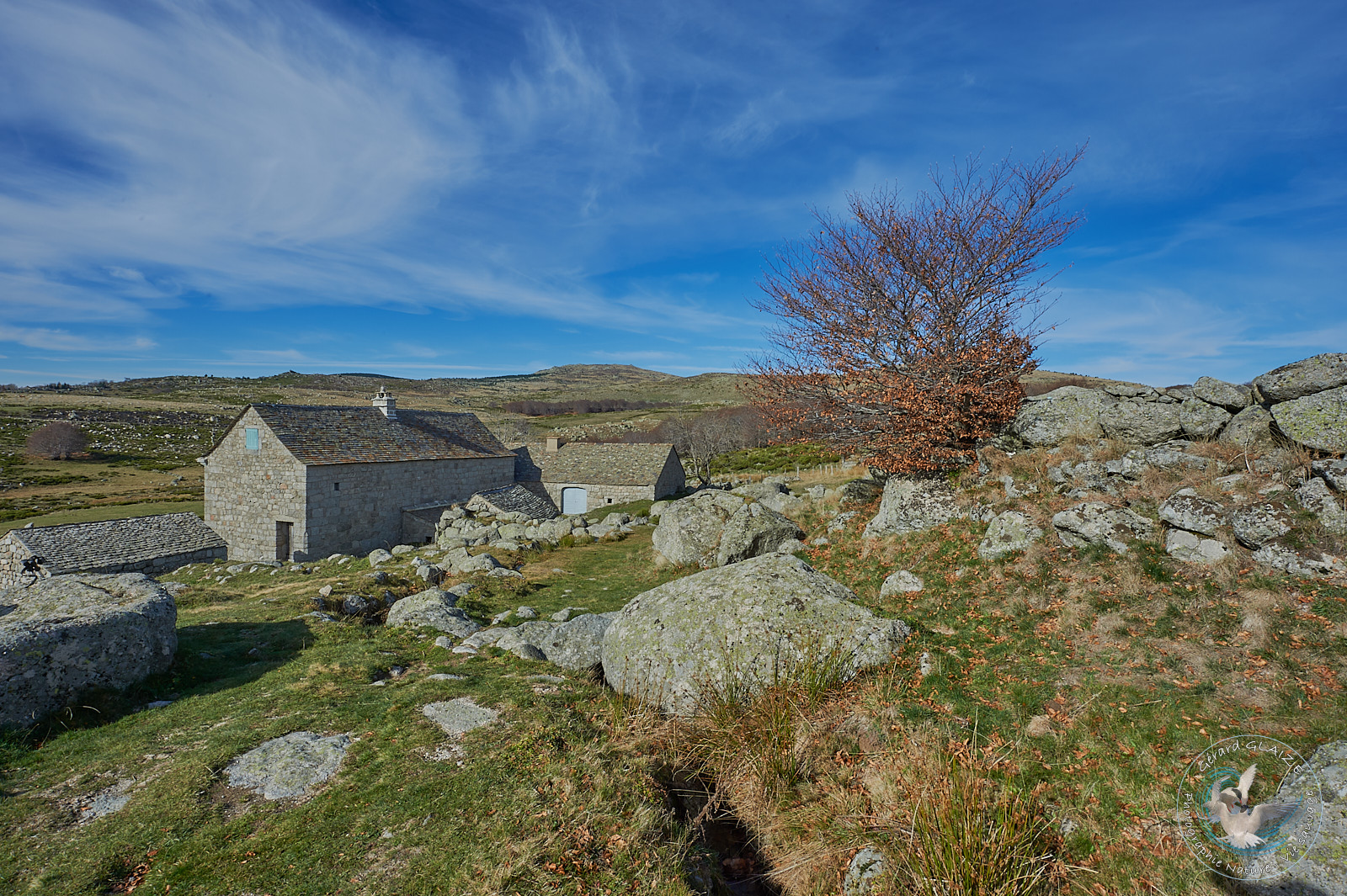
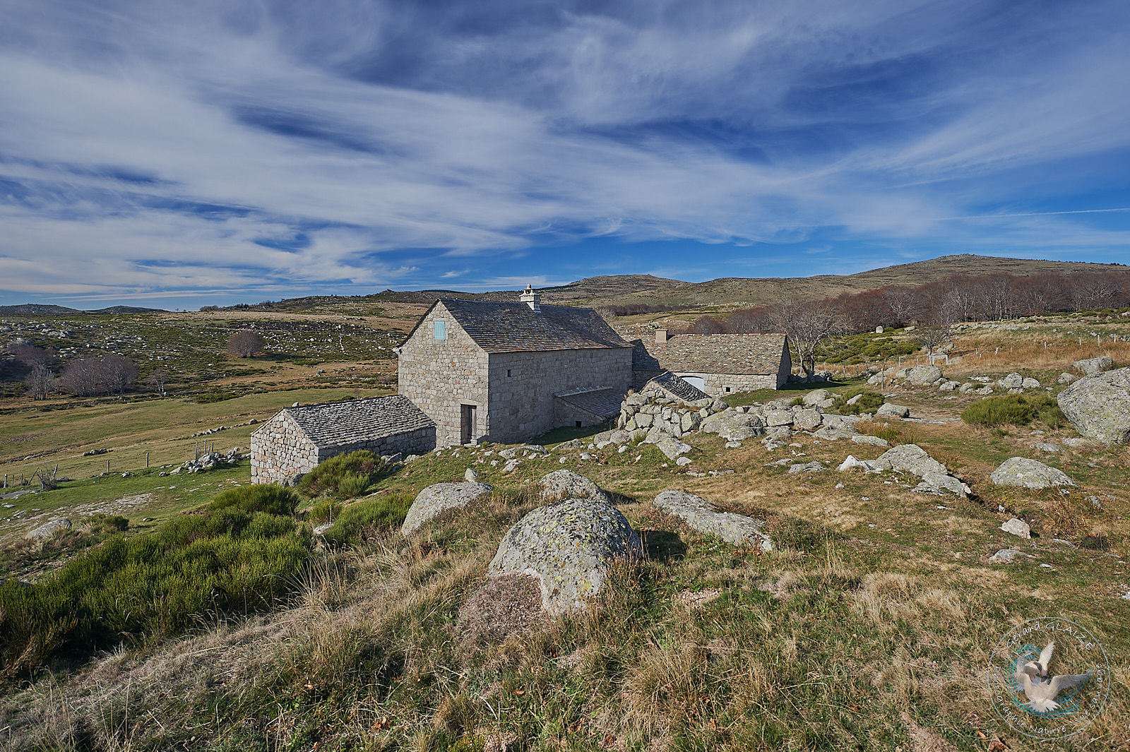
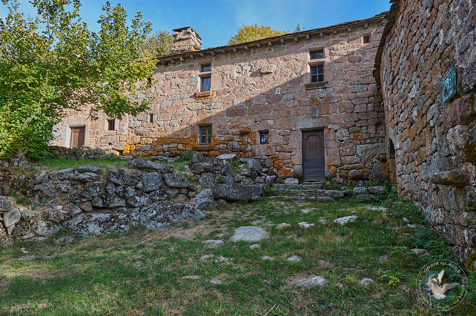
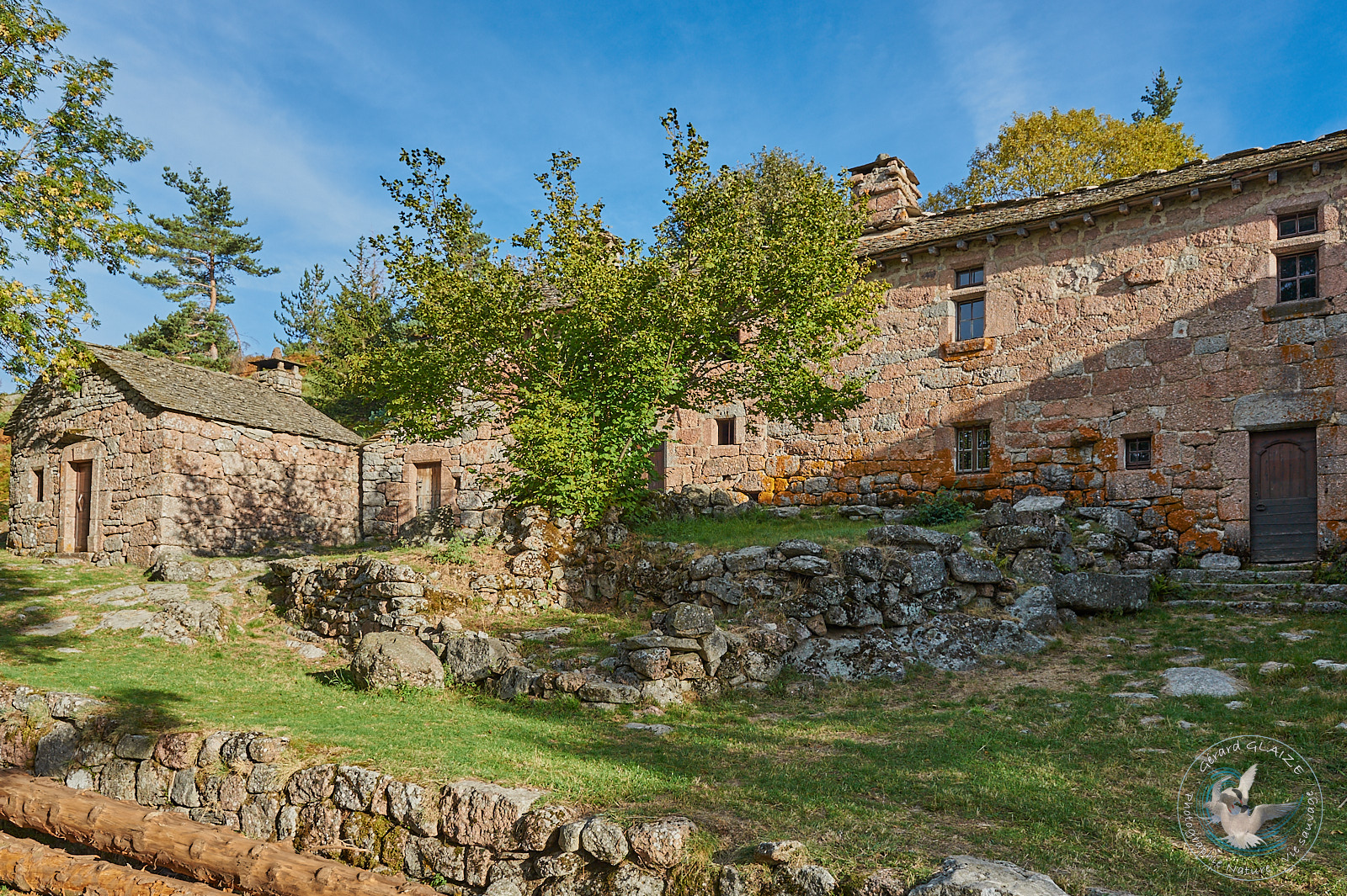
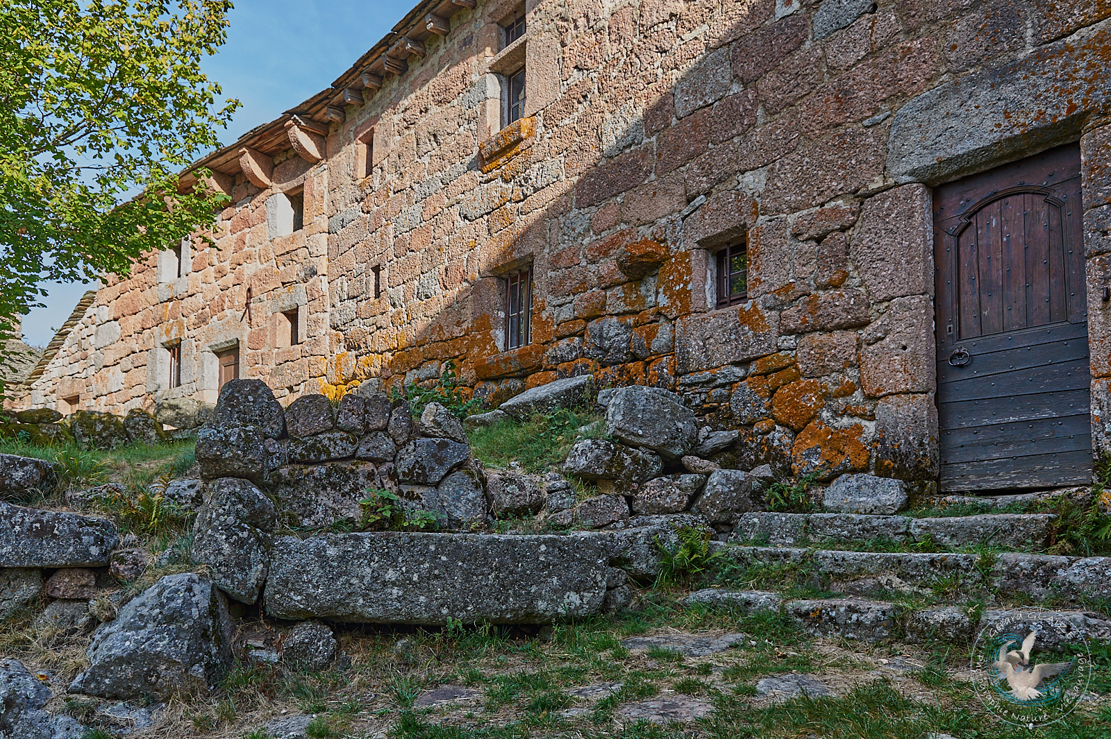
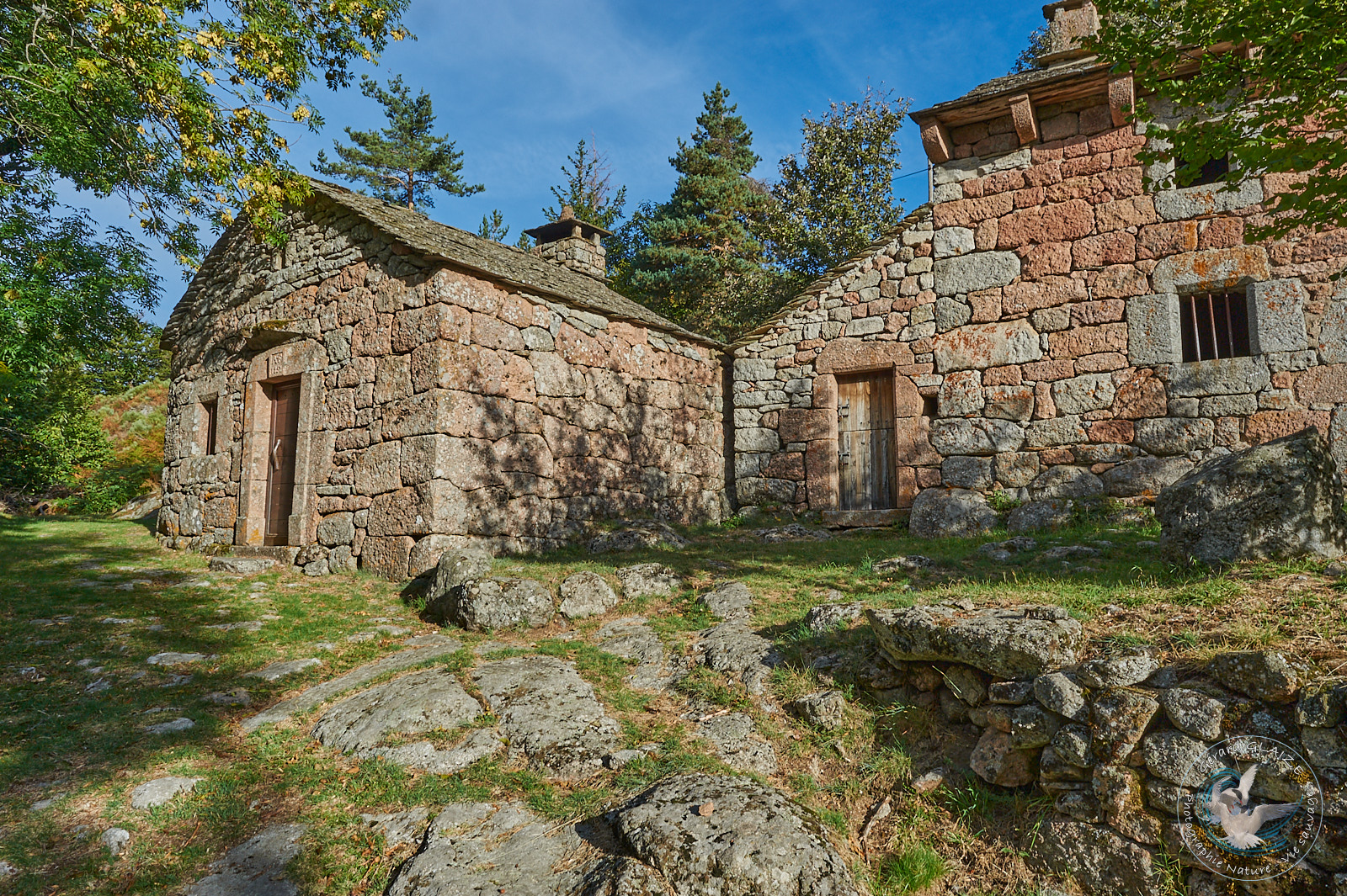
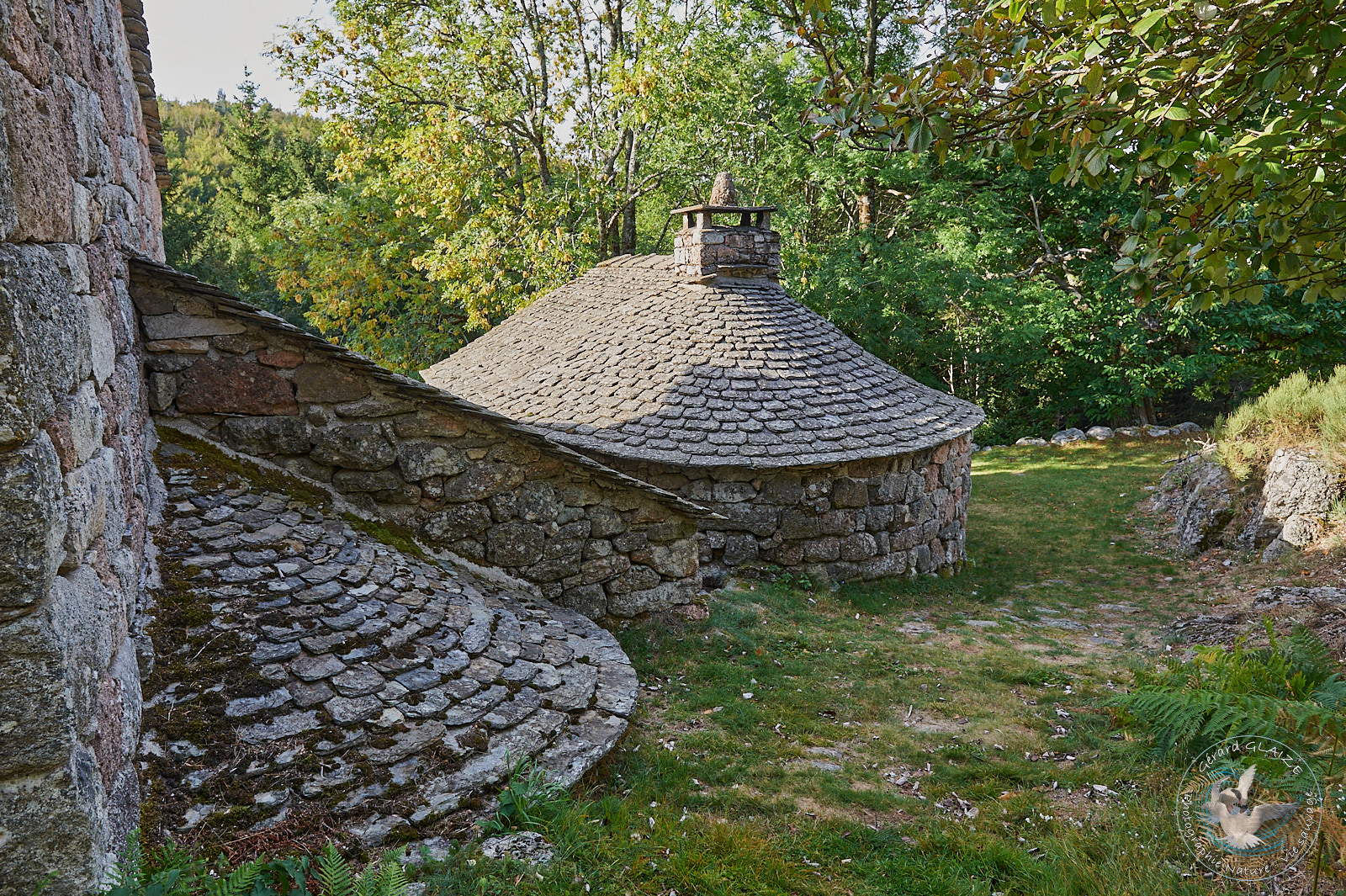
- The Troubat farm, which is part of the Mont Lozère ecomuseum, is a former agricultural operation. It is made up of several pink granite buildings, dating from the 16th and 17th centuries. This ensemble has been abandoned since the beginning of the 20th century. The farm has retained its barn, its bread oven, and its threshing floor. This farm is built in pink granite, hence the very particular colors of this architectural ensemble.
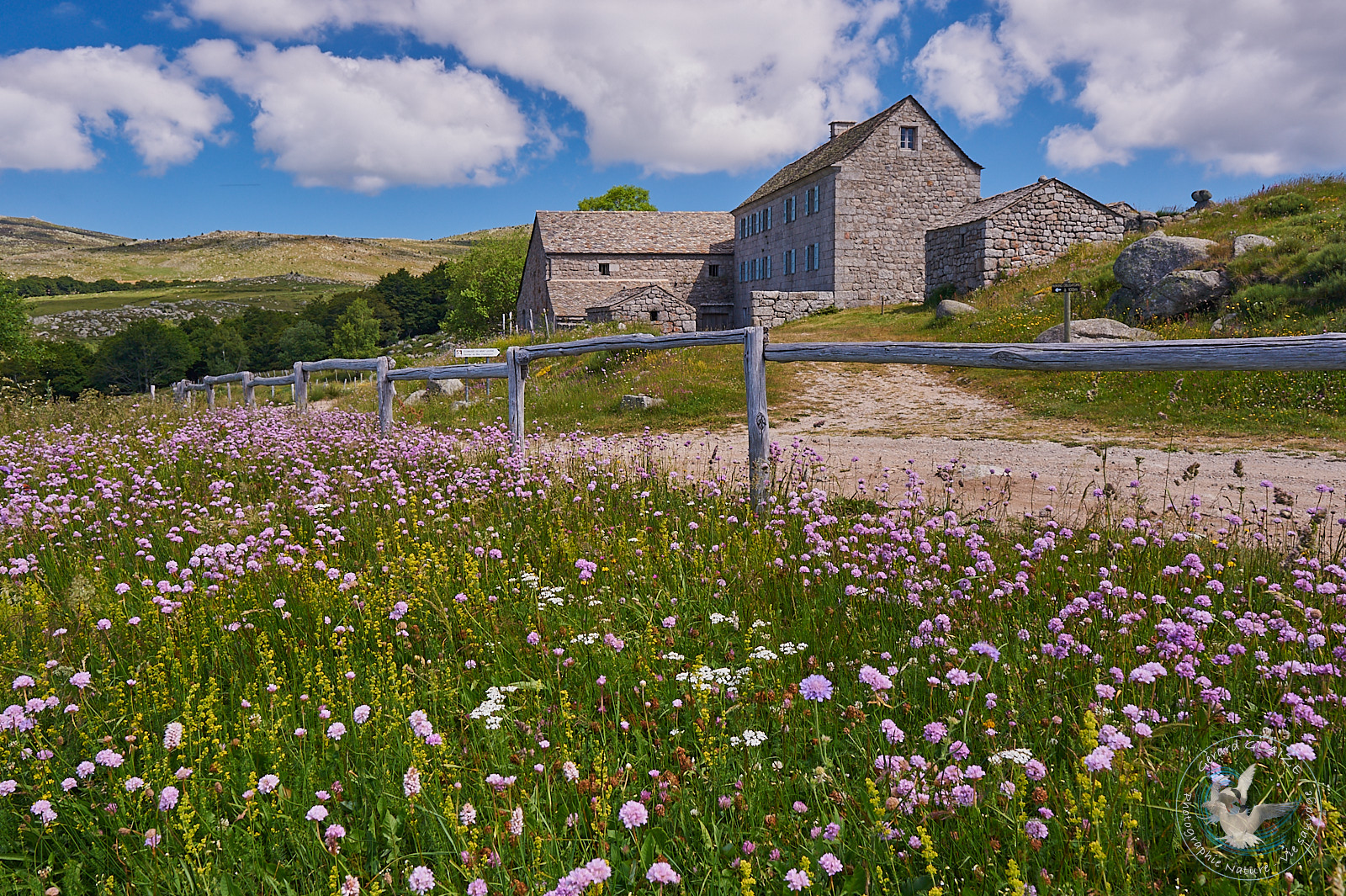
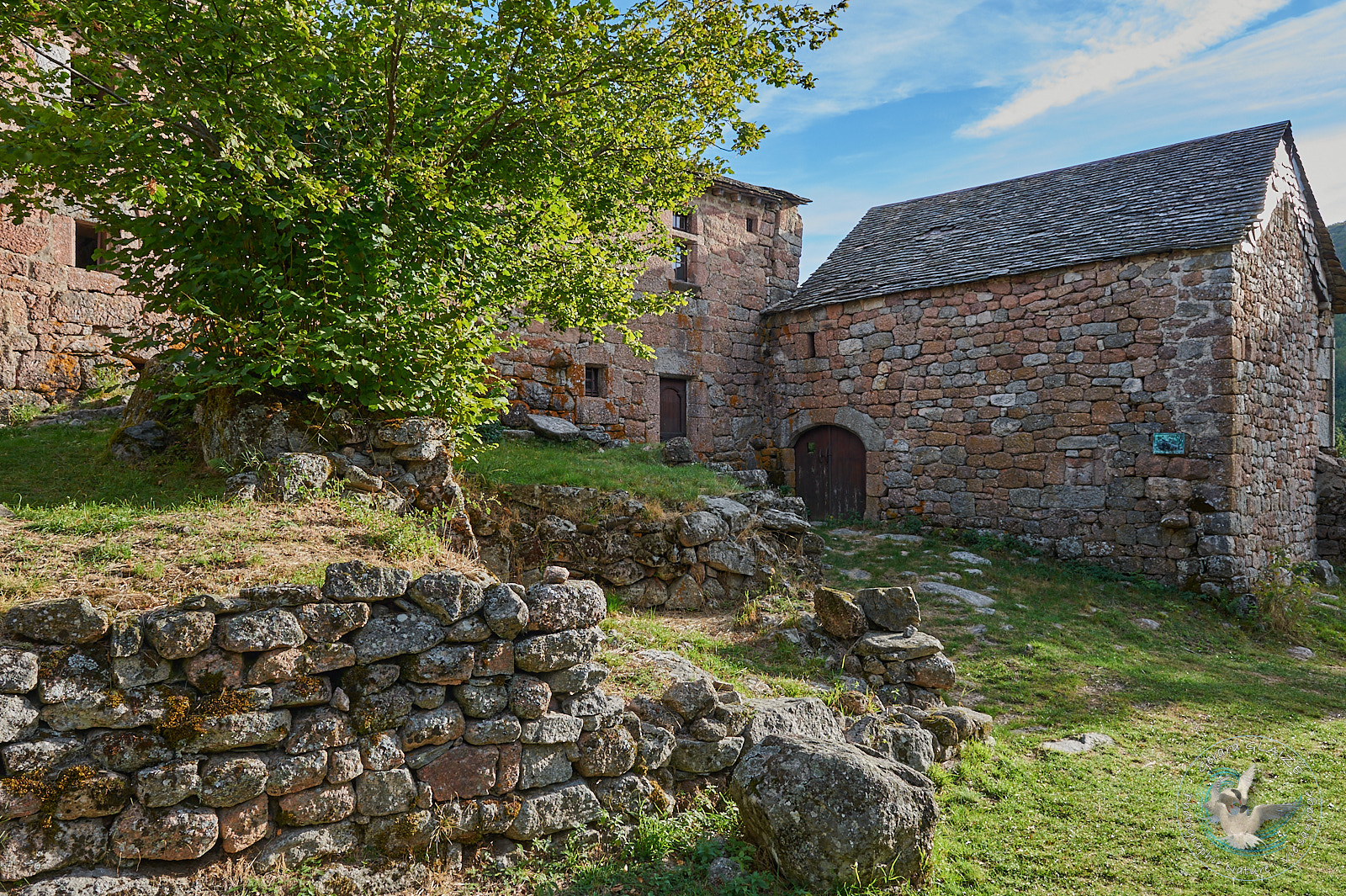
- Mas Camargue is located in the central area of the Cevennes National Park. This old farmhouse is a witness to the agricultural activity of the last century. Archival documents from the 15th century relate that this domain belongs to the lord of Portes. At the end of the 19th century, farmers from Mont Lozère became owners. Victim of its isolation and agricultural developments, the farm, despite its technical advances and its beautiful housing, was abandoned at the end of the First World War. The Tarn River has its source near this magnificent Mas, in a group of peat bogs.
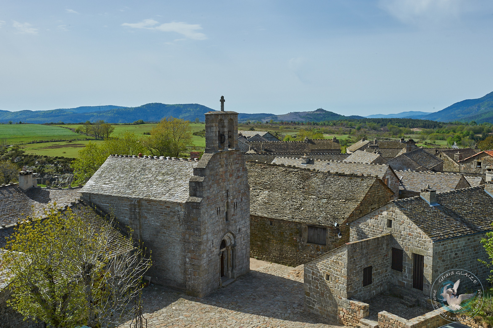
Village of Garde Guerin
Located at the gates of the Cevennes at approximately 900 meters above sea level, La Garde Guerin is a small medieval town from the 12th century. This medieval village is located on the Regordane route.
The Regordane way, a communication route since the 12th century between Nîmes and Puy en Velay, crosses this region. Its origin would even be much older and go back before Roman civilization. There are fortified points along its path: the Château de Portes (at the top of the pass of the same name), in the direction of Alès, while further north, after Villefort, is the medieval village (listed as a historic monument) of the Garde Guerin, which dominates the Chassezac gorges.
This village has a very beautiful Romane church from the 12th century, dedicated to Saint-Michel, patron saint of the Knights Pariers. In 1929 this Romane church was classified as a “Historic Monument”. It is one of the most remarkable religious monuments in the region.
Furthermore, in 1992, the village served as the setting for Christian Fechner’s film: “Justinien Trouvé or the Bastard of God”.
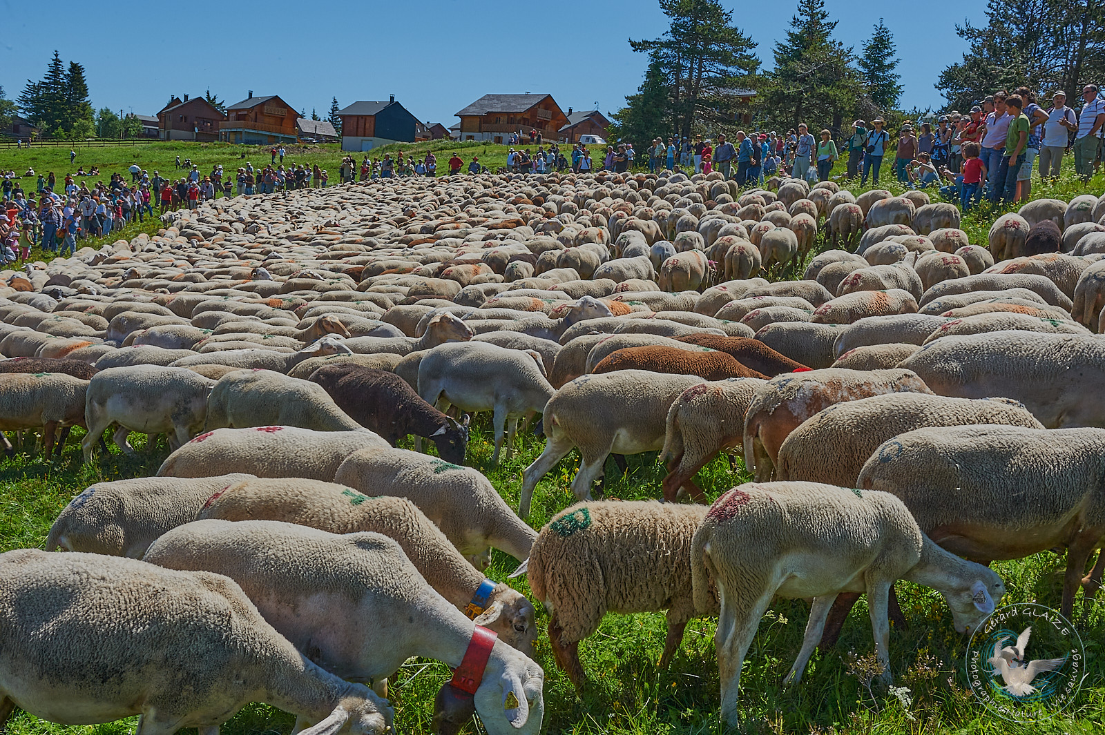
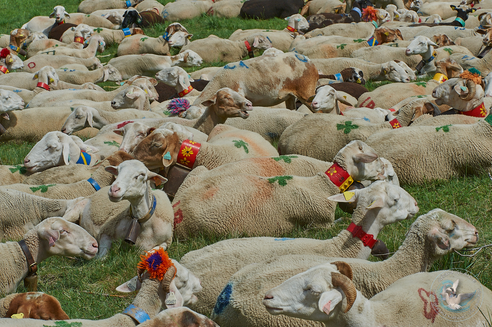
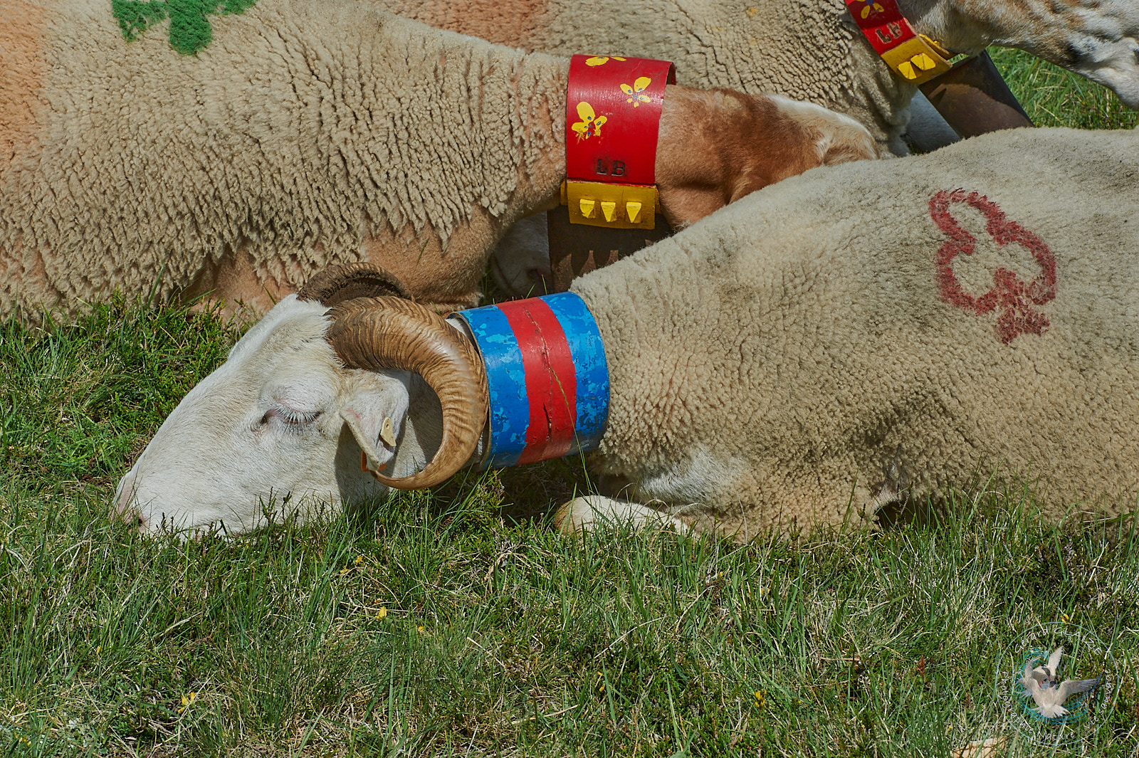
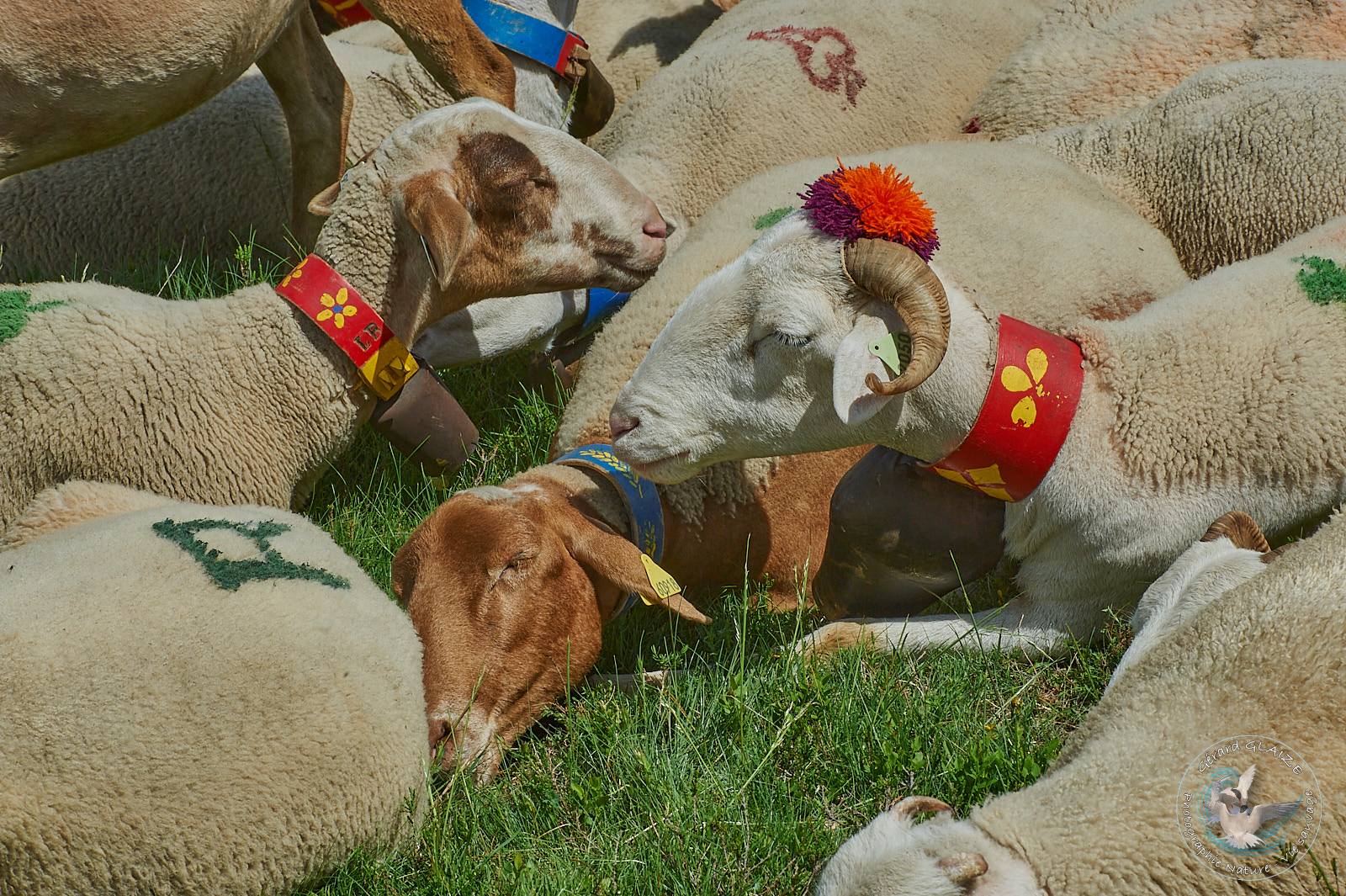
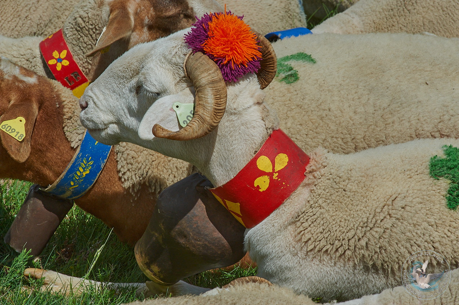
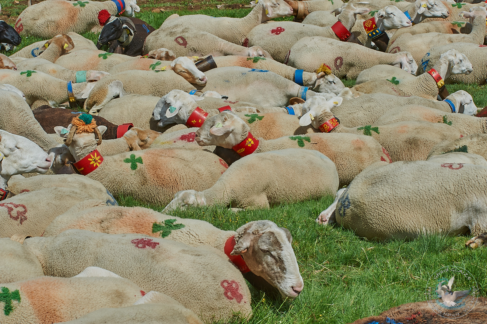
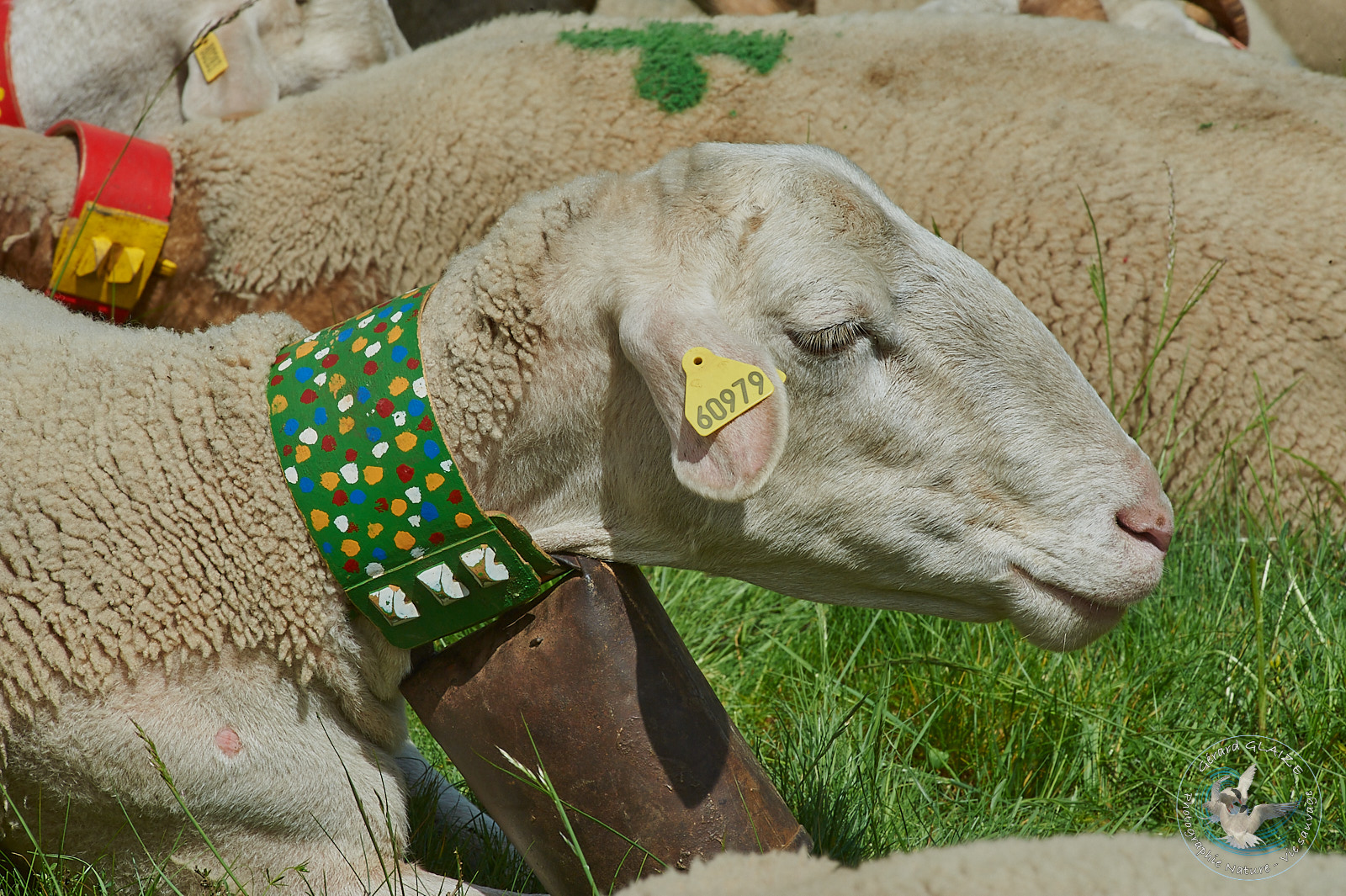
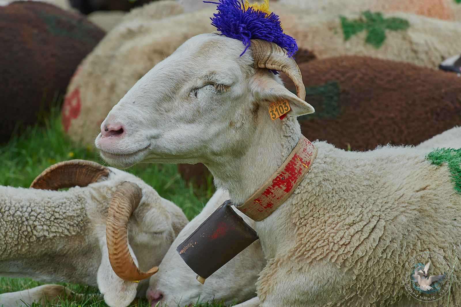
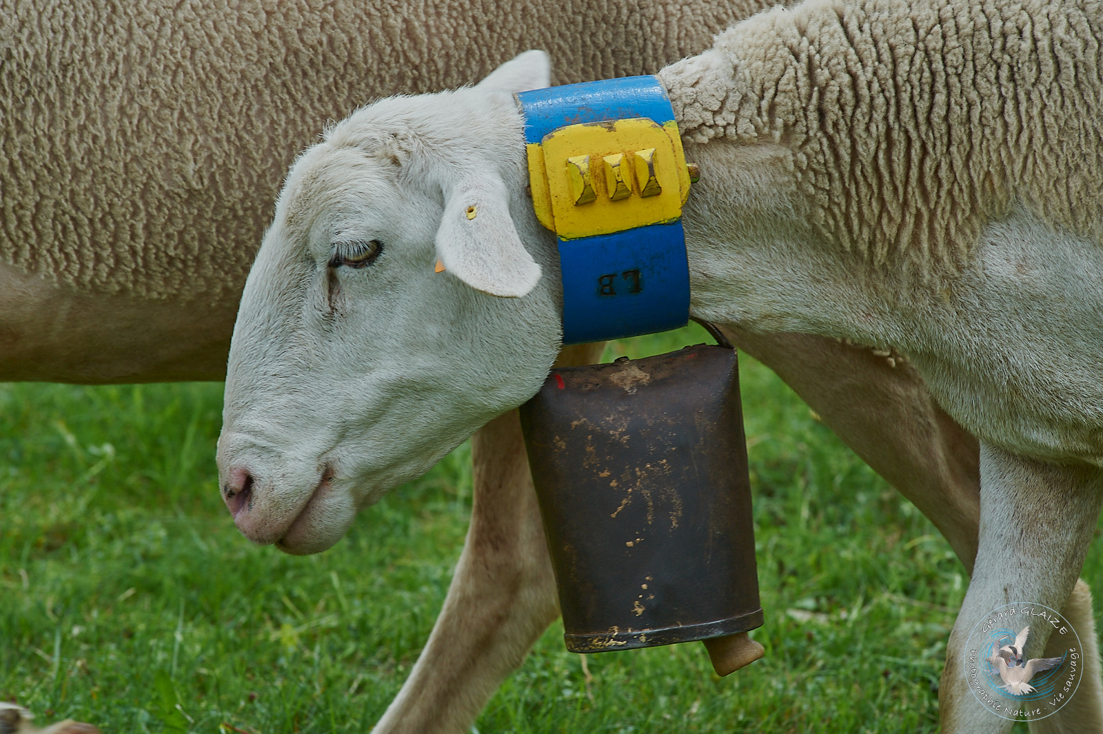
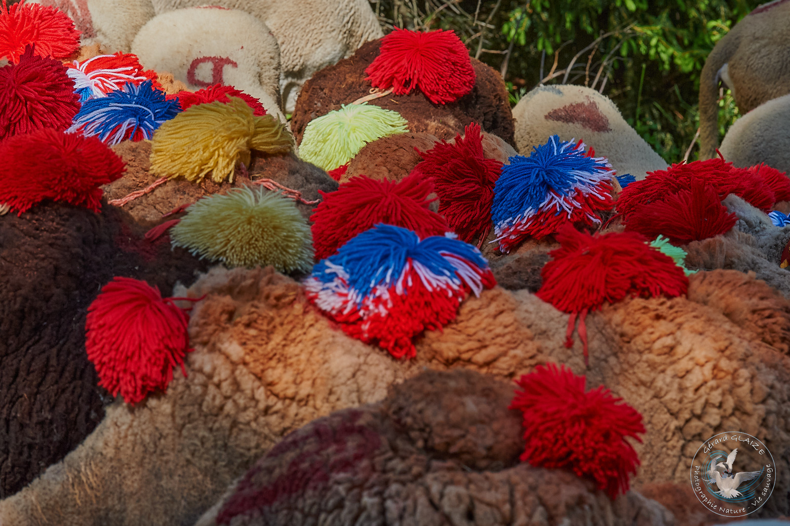
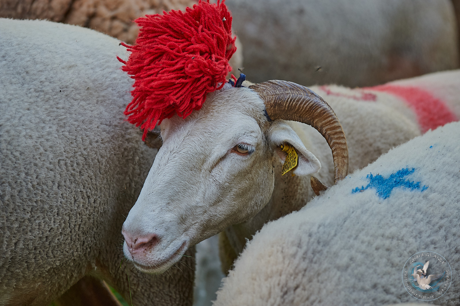
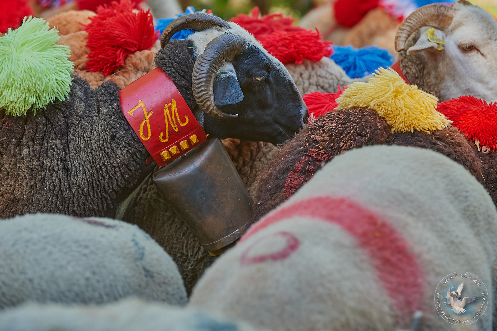
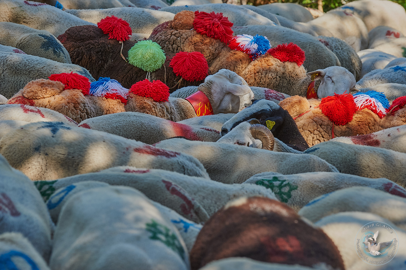
Transhumance Festival at Esperou village
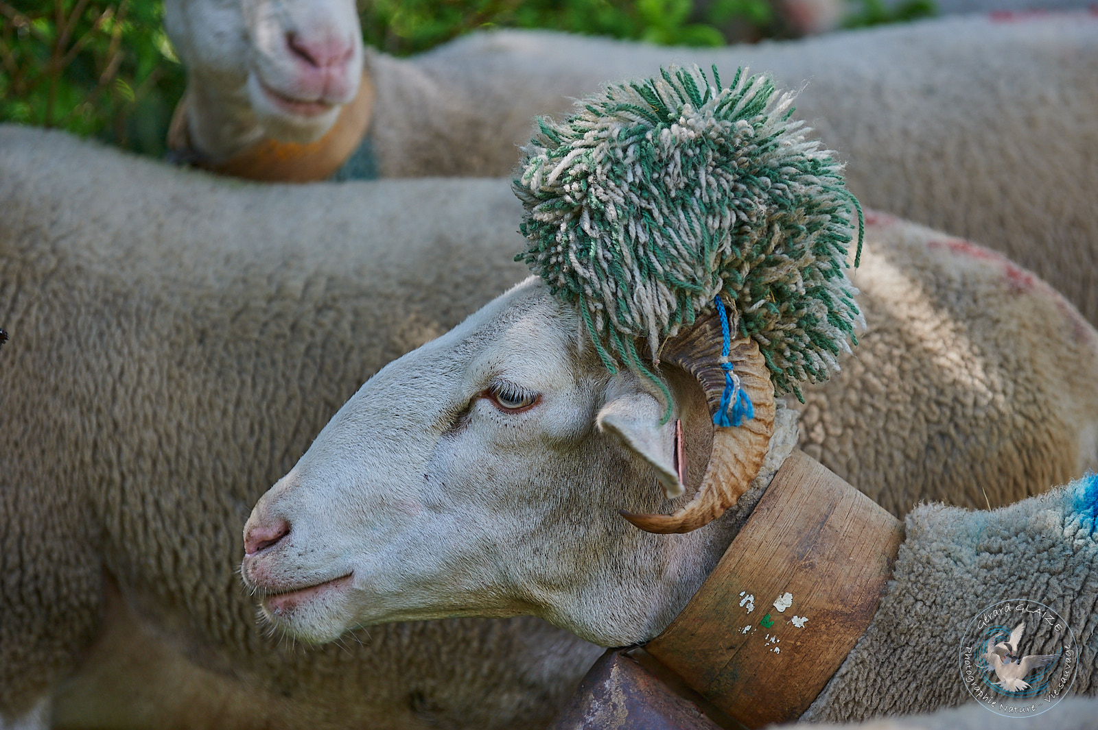
Transhumance, cowbells and pompoms, such is the theme of this festival. This takes place every year, around June 15 in Esperou. This village near Mont Aigoual brings together several herds for this festival. Some villages of the Cevennes still retain several herds of sheep, thus perpetuating a thousand-year-old transhumance.
The herds go up in transhumance, for the summer months towards the high altitude pastures of Mont Aigoual and Mont Lozere, around mid-June. Then they will then come back down in September.
The herds follow very old “drailles” itineraries and paths, traced over the centuries. These drailles connect the plains of Languedoc to the mountainous regions of the central massif.
This festival is organized by the Union of Sheep Breeders of Gard, the Chamber of Agriculture of Gard and with the participation of numerous partners. We are happy to see the festive side of this event, and the sheep are always well dressed. Indeed, very colorful wool pompoms, and bells adorn the sheep.
The chestnut tree
The chestnut tree is an integral part of Cevennes culture. This tree’s growing area is between 500 and 800 meters above sea level. It is the daily food of the Cevennes, who consumed its fruit, the chestnut. This tree was also nicknamed the breadfruit of the Cevennes. Chestnut wood, on the other hand, was used for frames, furniture and barrels.
The hollowed-out chestnut tree trunks, covered with slate slate, also served as hives for bees. These trunk hives are specific to the Cevennes. 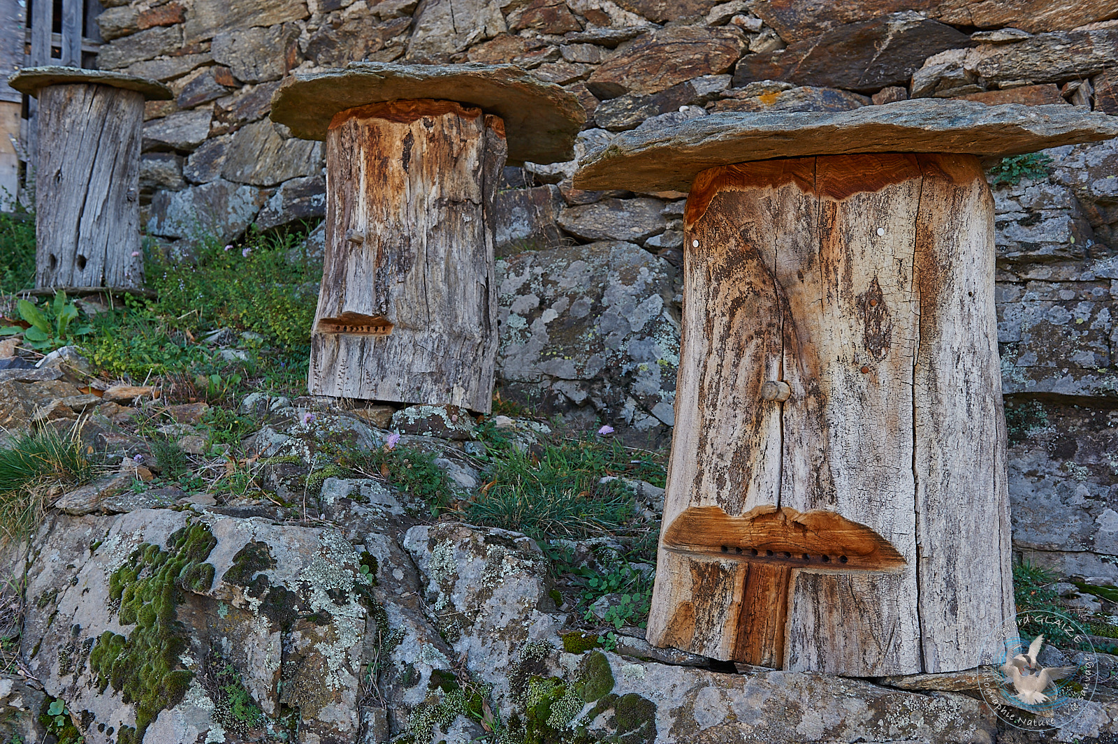 Some beekeepers still use this type of hive.
After collection, the chestnuts were stored in premises called “clèdes” which allowed them to dry. The chestnuts were finally arranged on racks. A fire was lit underneath, allowing the chestnuts to “sweat”. The process was repeated until the clède was all garnished with sweated chestnuts. We then maintained a low heat for two or three days to complete the drying.
Today, chestnut cultivation is abandoned. Despite this, some chestnut groves are still cultivated. The chestnuts harvested in this way are used to make liqueur, jam and flour.
Silk, and silkworm breeding
Sericulture in the Cevennes is very old. However, it was only at the beginning of the 17th century that it really took off. The mulberry plantations necessary for the breeding of the evening worm (Mulberry Bombyx) thus succeeded the chestnut trees. The habitat was transformed with the construction of “silkworm factories”, places for breeding silkworms. These farms were at the origin of a very prosperous spinning and hosiery industry.
However, the last Cevennes spinning mill closed its doors in Saint Jean du Gard in 1965. Cevennes siriculture was the victim of several hazards (farming diseases, importation of foreign silks, development of artificial silk). However, sericulture was revived in the Cevennes in the 1970s. Cevennes silk is processed on site (from cocoon production to the finished product). It ultimately gave birth to an artistic craft.
Travel with a donkey through the Cevennes
The young Scottish writer Robert Louis Stevenson who traveled the Cévennes in 1878 with his donkey “Modestine” from Monastier sur Gazeille in Haute-Loire to Saint Jean du Gard, recounts his adventure in a book “Travel with a donkey through the Cevennes”. This story was published in 1879 by the man who became a famous writer with his novels “Treasure Island” and “Doctor Jekyll and Mr Hyde”.
“I had been looking for adventure all my life, a pure and passionless adventure, as happened to the heroic travelers of the first times; and to find myself thus, in the morning, in a lost and wooded corner of Gévaudan, disoriented, too. foreign to what surrounded me that the first man abandoned in the land was to see, fulfilled, a part of my waking dreams.” Robert Louis Stevenson.
The GR 70 now allows us to repeat this initiatory journey. You will thus discover :
- the Haute Loire presenting a volcanic landscape with its basalt rocks, and its red and black colors,
- Lozere with a rather granite landscape, Mont Lozere in particular,
- the Cevennes with its deep valleys, its landscapes of schist and chestnut trees.
If you are tempted by adventure, the Association on the path of Robert Louis Stevenson can help you organize your hike.
World Heritage Listing
Since June 2011, the Causses and the Cévennes have been listed as a UNESCO world heritage site as a cultural landscape of Mediterranean agro-pastoralism.
This recognition 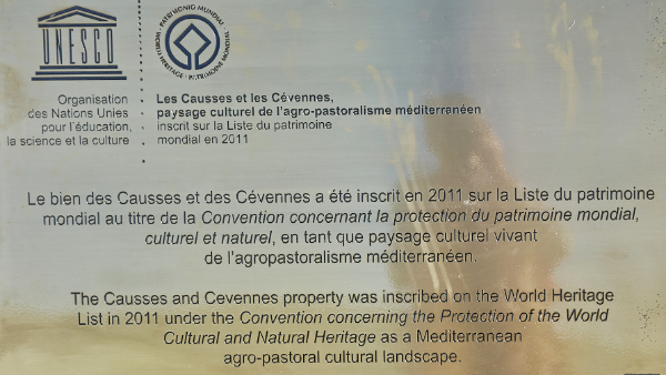 thus recognizes the value of an exceptional site whose hand of man has shaped these landscapes for millennia.
Hiking information
The Cévennes are a mountainous region, Mont Aigoual and Mont Lozère in particular have a mountain climate given the altitude of these two massifs. Some precautions are therefore necessary before any hikes in this region.
Basic advice for all hikes:
- Be properly equipped: walking shoes, warm clothing, change of clothes, preferably bright clothing, etc.
- Have a first aid kit (injury in case of a fall), and a flashlight.
- Bring drinks, food (energy bars, etc.)
- Choose a route that matches your fitness level.
- Inform someone close to you about the route you plan to take.
- Avoid going alone.
- Check the weather for the location you plan to travel to.
Weather Forecast in Mont Lozère
Quote of the moment
« La vie échappe au temps dans ces solitudes silencieuses. Elle s’y recroqueville sur elle même en écoutant leurs vents, leurs eaux et leurs forêts. Tout semble établi depuis les origines du Monde. »
André CHANSON, Cévennes 1957.